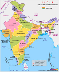
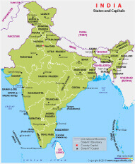
India Map showing Indian states, UTs and their capitals. Download free map of India here for educational purposes and personal use.
India, the seventh-largest country in the world, is known for its rich heritage and diverse culture. It is the most populous democracy in the whole world and surrounded by three water bodies: The Indian Ocean, The Arabian Sea and The Bay of Bengal. The country has 28 states, 8 Union Territories that includes the National Capital Territory of Delhi. The capital city of New Delhi in the north is marked in red. It is bordered by the states of Haryana and Uttar Pradesh. India has many places that serve as attractions for tourists from all across India and from across the globe.
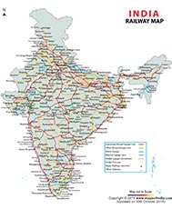
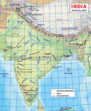
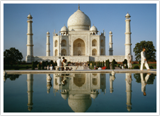
Taj Mahal isn't the only place to visit. The country has much more to offer, ranging from its historical sites, festivals, people from different cultural practices, and countless breathtaking places. The India map, shown above is a helpful tool to understand the demographics, political and geographical boundaries of the country. Besides being a repository of maps for railways, travel attractions, roads, and many other such information contents, Maps of India also offers state maps, district maps, city maps, village maps, and much
more.