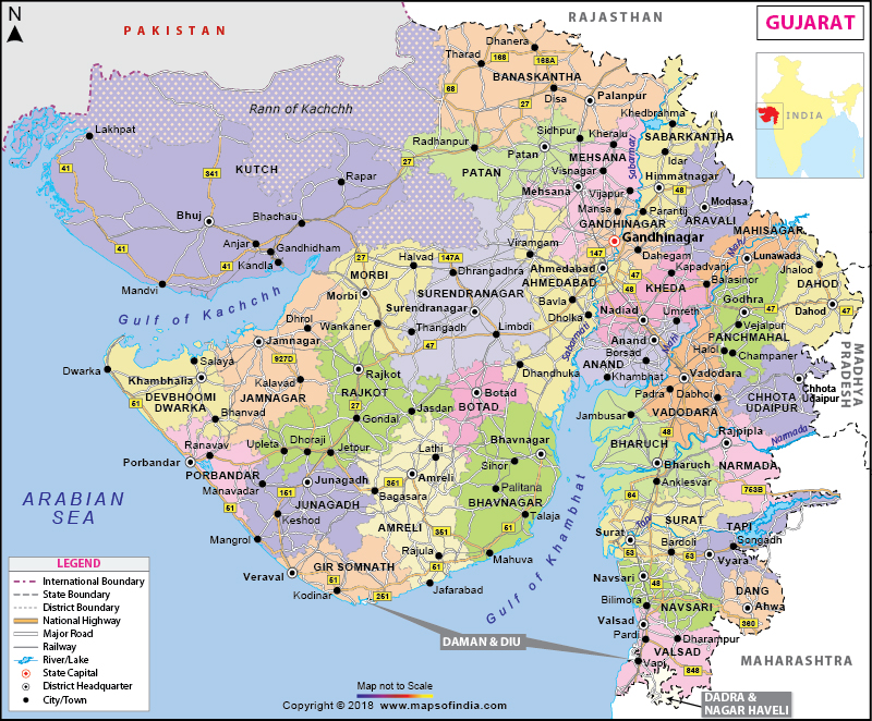
| Disclaimer: All efforts have been made to make this image accurate. However Mapping Digiworld Pvt Ltd and its directors do not own any responsibility for the correctness or authenticity of the same. |
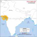
The capital of Gujarat is Gandhinagar and its largest city is Ahmedabad. The population of Gujarat State is 50,671,017 (2001 census). Gujarat covers an area of 1, 96,024 sq km and shares its border with states of Rajasthan, Madhya Pradesh and Maharashtra. The state has a literacy rate of 79.31 percent. Gujarat is the 7th largest state in India in terms of area. The 196,024 sq kms of area in the state is divided into 26 districts at present. Gujarat had 17 districts when it was formed in the year 1960. All the northern districts of the Bombay, which was a state in its own till then, were a part of Gujarat after 1960.
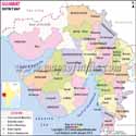
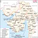
The 33 districts of Gujarat are: Ahmedabad, Amreli, Anand, Aravalli, Botad, Banaskantha, Bharuch, Bhavnagar, Chhota Udaipur, Dahod, Dang, Devbhoomi Dwarka, Gandhinagar, Gir Somnath, Jamnagar, Junagadh, Kheda, Kutch, Mehsana, Mahisagar, Morbi, Narmada, Navsari, Panchmahal, Patan, Porbandar, Rajkot, Sabarkantha, Surat, Surendranagar, Tapi, Vadodara and Valsad.
The biggest district in this state in terms of area is Kutch District which has Bhuj as its city headquarters. The district covers 45,652 sq kms of the total area in the state and the population density in the district is that of 46/km2.
Gandhinagar is the smallest district in terms of area in Gujarat. The total area covered by the district is merely 649 sq kms. This added to the presence of Gandhinagar, the state capital after which the district is named makes it, the district with most population density. Total population in the district is 1,387,478.
The most populated of all the districts in the state is the Ahmedabad District which also is the 8th most populous district in India. The district shares its borders with Mehsana in the North, Surendranagar in the West, Kheda in the East and Bhavnagar in the South.
Dang district is the least populated district in the state. Around 226,769 people live in the district as per the census 2011. The district extends to 1764 sq km in area.
Valsad district is located to the Southern most end of the state of Gujarat and it has covers an area of around 3034 sq km in the state of Gujarat. The Valsad district shares its border with Navsari District to the North. Navsari district is located in an area of 2211 sq km.
Jamnagar district located on the Southern Coast of the state of Gujarat, covers an area of around 14125 sq km.
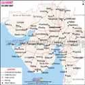
The district map of Gujarat will show you the all the districts demarcated clearly in grey dotted lines and all the district headquarters are marked in grey circles.
Gujarat State Information |
|
|---|---|
| Capital | Gandhinagar |
| Date of formation | 1. May. 1960 |
| Governor | Shri Om Prakash Kohli |
| Chief Minister | Anandiben Patel |
| Tourist attractions | Gir NP, Somnath Temple, Dwarka, Palitana |
| Festivals | Navratri, Kite Festival, Kutch Utsav |
| Major dance and music forms | Bhavai |
| Arts and crafts | Bandhani or tie-and-dye fabric; woven Patola fabric; rich embroidery by the Rabari tribals including Soof embroidery. |
| Languages | Gujarati |
| Size | 196,244 sq. km |
| Population (Census 2011) | 60,439,642 |
| Rivers | Sabarmati, Mahi, Narmada, Tapti, Banas, Saraswati, Damanganga |
| Forests and wildlife sanctuaries. | Gir NP, Wild Ass Sanctuary Kutchch, Nal Sarovar Bird Sanctuary, Velavadhar NP, Vansda NP |
| State animal | Asiatic Lion |
| State bird | Greater flamingo |
| State flower | Galgota |
| State tree | Mango |
| Major crops | Groundnuts, cotton, tobacco |
| Factoids | It is possible to climb down the richly-carved step-wells or vavs of Gujarat. |
| The ancient fort Uparkot was first built by the Mauryas. | |
| No. of District | 33 |
| Location Map | Physical Map | Outline Map |
| Lat Long Map | Elevation Map | Mandal Map |
| District Map | Sex Ratio Map | Forest Map |
| Industry Map | Agriculture Map | Railway Map |
| Road Map | Tehsil Map | River Map |
| Geography | History | Weather |
| Area | Facts | Districts Factsheet |
| Flora and Fauna | Topography | Textiles |
| People | Dresses | Food |
| Art and craft | Fairs and Festivals |
| Travel to Ahmedabad | Travel to Bhavnagar | Travel to Bhuj |
| Travel to Dwarka | Travel to Gandhi Nagar | Travel to Gondal |
| Travel to Surat | Travel to Utelia | Travel to Vadodara |
| Travel to Zainabad |