| Disclaimer: All efforts have been made to make this image accurate. However Mapping Digiworld Pvt Ltd and its directors do not own any responsibility for the correctness or authenticity of the same. |
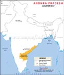
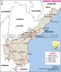
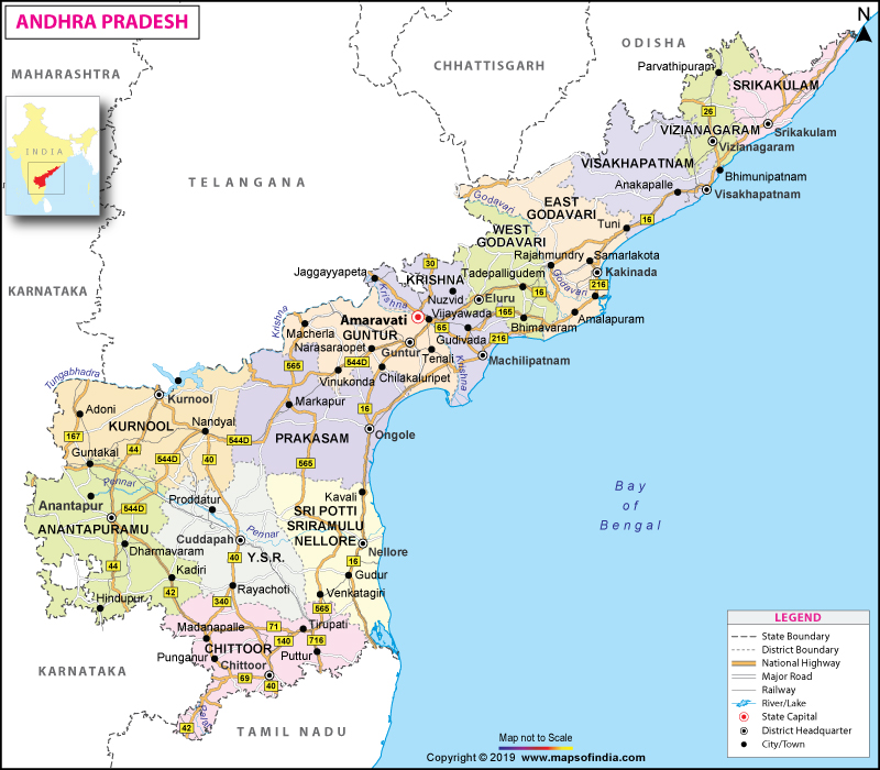
The state of Andhra Pradesh is located along the eastern coast of southern India. It shares its boundary with Odisha, Chhattisgarh, Telangana in the north, Tamil Nadu in the south, the Bay of Bengal to the east and Karnataka in the west and south-west. Andhra Pradesh is the eighth largest state of India by area and tenth largest in terms of population. It has the second longest coastline (974 km) in India after Gujarat.
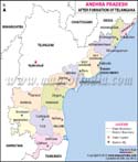
Following the state's bifurcation in 2014, Hyderabad has been serving as the shared capital of Andhra Pradesh and Telangana. The city of Hyderabad is famous for its rich cultural heritage. Andhra Pradesh has thirteen districts after the recent bifurcation. Some of its important districts are Anantapur, Chitoor, Guntur, Nellore, Kurnool and Visakhapatnam. The state will have its own official capital at Amravati from 2024 onwards.
The history of Andhra Pradesh goes back to the Vedic period. Its earliest mention is found in the ancient text Aitareya Brahmana. There is evidence to suggest that the coastal kingdom of Andhra Pradesh was thriving during the age of Satavahanas. There is also proof that Buddhism flourished here when the Ikshvakus of Nagarjunakonda came to power.
The Andhra region came under the control of the Kakatiya Dynasty, Reddy Dynasty, Vijaynagar Empire as well as the Mughal rule and then the British Empire in 1792. After independence, the princely state of Hyderabad became a part of India in 1948. The state of Andhra Pradesh was created on linguistic lines and merged with the Telugu speaking area of Telangana in 1956 through the State Reorganisation Act. The Telengana Movement began after that and Andhra Pradesh was bifurcated in 2014.
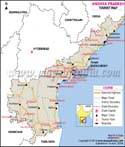
There are a number of places to visit in this beautiful state. The city of Visakhapatnam is a wonderful beach destination with beautiful lakes, valleys, caves and hill ranges. The Araku Valley is a famous hill station rich in biodiversity; it has coffee plantations and waterfalls. Horsley Hills is another famous hill station.
Other places to visit here include Lake Gangotri, Environmental Park, Horsely Museum and Gali Banda.
Andhra Pradesh is also home to Kolleru Lake, one of largest freshwater lakes in India. It is situated between the Krishna and Godavari Delta. There are various religious and pilgrimage sites as well, such as Tirupati which is visited by millions of devotees year after year. Nellore also has immense spiritual significance. Vijaywada has beautiful heritage sites, caves and hills. Chittor is an agricultural town also famous for its hills, rivers and forts. It is home to the Nagari Hills, Horsley Hills and Kaundinya Wildlife Sanctuary.
Kurnool has several caves and forts; the city is surrounded by mountain ranges. Anantapur is famous for diamond mining. It houses one of the largest trees in the world, the branches of which are spread over 2.5 acres.
Andhra Pradesh holds the second position in India in terms of its mineral resources. Important industries in Andhra Pradesh include Information Technology, Biotechnology, Business Management, Pharmaceuticals and Real Estate. The official language of the state is Telugu. Urdu is the co-official language.
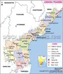
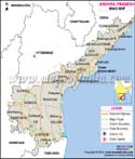
Map of Andhra Pradesh
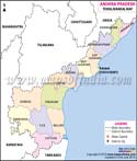
The map of Andhra Pradesh shows that the state is made up of 13 districts. Given below are the names of all these districts in Andhra Pradesh and important information about these districts:
| District | District Code | Population (2011) | Headquarters | Area (km2;) | Total Female | Total Male |
|---|---|---|---|---|---|---|
| Anantapur | AN | 4083315 | Anantapur | 19130 | 2018387 | 2064928 |
| Chittoor | CH | 4170468 | Chittoor | 15152 | 2086963 | 2083505 |
| East Godavari | EG | 5151549 | Kakinada | 10807 | 2582130 | 2569419 |
| Guntur | GU | 4889230 | Guntur | 11391 | 2448102 | 2441128 |
| Kadapa | CU | 2884524 | Kadapa | 15359 | 1430388 | 1454136 |
| Krishna | KR | 4529009 | Machilipatnam | 8727 | 2268312 | 2260697 |
| Kurnool | KU | 4046601 | Kurnool | 17658 | 2006500 | 2040101 |
| Nellore | NE | 2966082 | Nellore | 13076 | 1472828 | 1493254 |
| Prakasam | PR | 3392764 | Ongole | 17626 | 1680029 | 1712735 |
| Srikakulam | SR | 2699471 | Srikakulam | 5837 | 1359041 | 1340430 |
| Vishakhapatnam | VS | 4288113 | Vishakhapatnam | 11161 | 2147241 | 2140872 |
| Vizianagaram | VZ | 2342868 | Vizianagaram | 6539 | 1180955 | 1161913 |
| West Godavari | WG | 3934782 | Eluru | 7742 | 1971598 | 1963184 |
A district magistrate is appointed to govern each district in the state.
Andhra Pradesh State Information |
|
|---|---|
| Capital | (Present) - Hyderabad (Proposed) Amaravati |
| Date of forrnation | 1st Nov 1956 |
| Governor | Biswabhusan Harichandan |
| Chief Minister | Y. S. Jagan Mohan Reddy |
| Tourist attractions | Araku Valley and Borra Caves in Vishakhapatnam, Nagarjuna Konda in Nagarjunasagar, Amaravati in Vijaywada, Lord Venkateswara Temple in Tirupati |
| Festivals | Sivaratri, Pongal, Vinayak Chaviti |
| Major dance and music forms | Kuchipudi, Bhamakalpam, Dappu |
| Arts and crafts | Kalamkari cotton, the Nakashis of Cheriyal village paint vibrantly coloured scrolls. |
| Languages | Telegu, Urdu, English |
| Size | 160,205 sq km |
| Population (Census 2011) | 49378776 |
| Rivers | Godavari, Krishna, Penneru, Kunder, Palleru, Cheyyeru, Charavati, Sarada, Nagavati |
| State animal | Blackbuck |
| State bird | Indian roller |
| State flower | Water lily |
| State tree | Neem |
| Major crops | Jowar, rice, bajra |
| No. of District | 13 |