
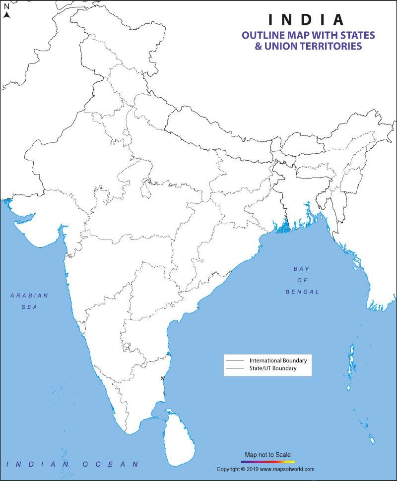
| Outline Map of India |
| Disclaimer: All efforts have been made to make this image accurate. However Mapping Digiworld Pvt Ltd and its directors do not own any responsibility for the correctness or authenticity of the same. |
India ranks as the seventh biggest nation in the world in terms of geographical territory and it is one of the biggest countries in South Asia as well. India shares its international boundaries with countries like Burma, Bangladesh, China, Bhutan, Pakistan and Nepal. The country covers a total area of 3,287,240 sq km. The shoreline of the country also extends for over 7,517 km and it is edged by the Arabian Sea, Bay of Bengal, and Indian Ocean.
India is a republic which is made up of 28 states and 8 union territories. The economy of the nation is quite diversified and consists of industries like conventional rural farming, contemporary agriculture, handicrafts, different types of current industries, and various other industries.
The service sector of India comprises mortgage companies, financial services providers, insurance companies, and consultancies. The country is famous all over the globe for the various tourist draws in the country. Some of the well-known tourist places in the country are Shimla, Darjeeling, Goa, Agra, New Delhi, Jaipur, Mumbai, Nainital, Mysore, Chennai, Kolkata, Srinagar, and Bangalore.
A Outline map of India helps you locate all the boundaries of the states in the country. It is a perfect guide for the students of geography to know about the various states in India along with their frontiers.
Blank outline maps of India are available in both online and offline versions. The offline version of this map is nothing but a printable outline map which can be used for educational purposes.
All the states and territories of the country can be divided into the following zones:
Free downloadable versions of the map are also available which the students can use for marking. Parents can use this map for educating their kids. They can get a printout and tell their kids for pointing out the various important places in India (states, capitals, seas, and ocean). This will help them enhance their knowledge about India.
One important advantage of using a blank outline map of India is that this map also indicates the international frontiers of the nation with other neighboring countries such as Bangladesh, Pakistan, China, Nepal, Burma and Bhutan. You can also get a glimpse of the Bay of Bengal, Indian Ocean and the Arabian Sea that edge the country to the southern side.