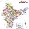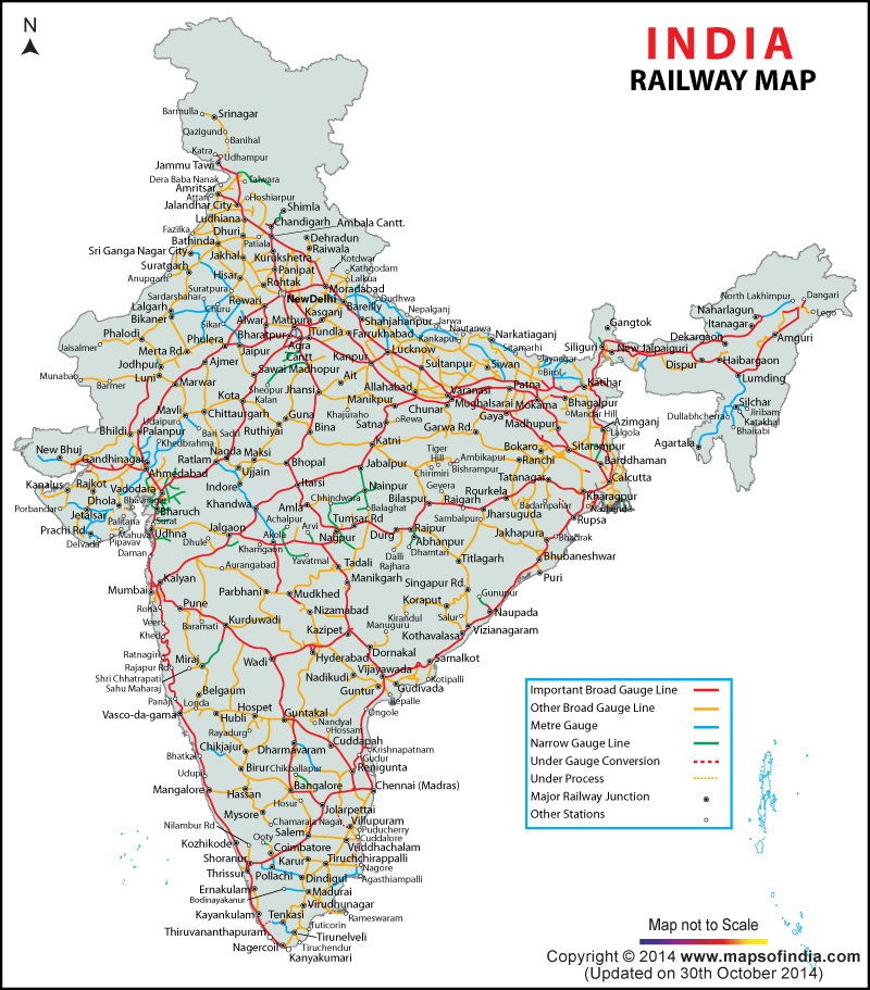
| * Indian Railways Map showing the network across the country with different zones - central railway, eastern railway, northern railway, north eastern railway, etc. |
| Disclaimer: All efforts have been made to make this image accurate. However Mapping Digiworld Pvt Ltd and its directors do not own any responsibility for the correctness or authenticity of the same. |
The Indian Railways is the principal mode of transportation for freight and passengers in India, and plays an important role in the development of industries and agriculture.
Indian Railways has had the distinction of being one of the biggest and busiest rail networks in the world. It operates 9,000 passenger trains and transports almost 18 million passengers every day. The Indian Railway employs approximately 1.4 million people.
The Indian Railways has been serving the people of India with utmost pride for more than two centuries. The first train journey was made in India in the year 1851, between Roorkee and Piran Kaliyar - for transferring large quantity of clay to Rorkee. The first passenger train journey became operational on 16 April 1853 between Bori Bunder, Bombay and Thane, covering a distance of 21 miles, thus marking the formal birth of the rail network in India.
The Indian Railway network binds the social, cultural and economical fabric of the country and covers the whole country ranging from North to South and East to West narrowing the distance barrier for its people. The railway network of India has brought together the whole of country, hence creating a feeling of unity among Indians.
India’s bid to take trains to Himalayan heights and the Railway’s aim to provide connectivity to all state capitals of the north-eastern region, led The Northeast Frontier Railway (NFR) to operate a train between Dibrugarh and Naharlagun. Arunachal Pradesh finally has the much-needed railway connectivity. As per media reports, Naharlagun, a town near the state capital Itanagar, is now part of the railway map of India. The Harmuti-Naharlagun line, which became functional in April 2014, was conceived in 1997 as part of a greater plan to improve connectivity in the Northeast.