
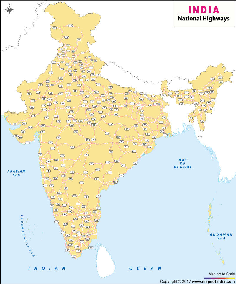
| *Map shows the national highways connecting the different cities of India |
| Disclaimer: All efforts have been made to make this image accurate. However Mapping Digiworld Pvt Ltd and its directors do not own any responsibility for the correctness or authenticity of the same. |
India has a huge network of national highways. The national highways have a total length of 70,548 kms. Indian highways cover 2% of the total road network of India and carry 40% of the total traffic. The entire highway network of India is managed by the National Highway Authority of India which is responsible for development and maintenance of highways.
The longest highway in India is NH7 which stretches from Varansi in Uttar Pradesh to Kanyakumari in the southern most point of Indian mainland. The shortest highway is NH47A which stretches from Ernakulam to Kochi and covers total length of 4 Kms.