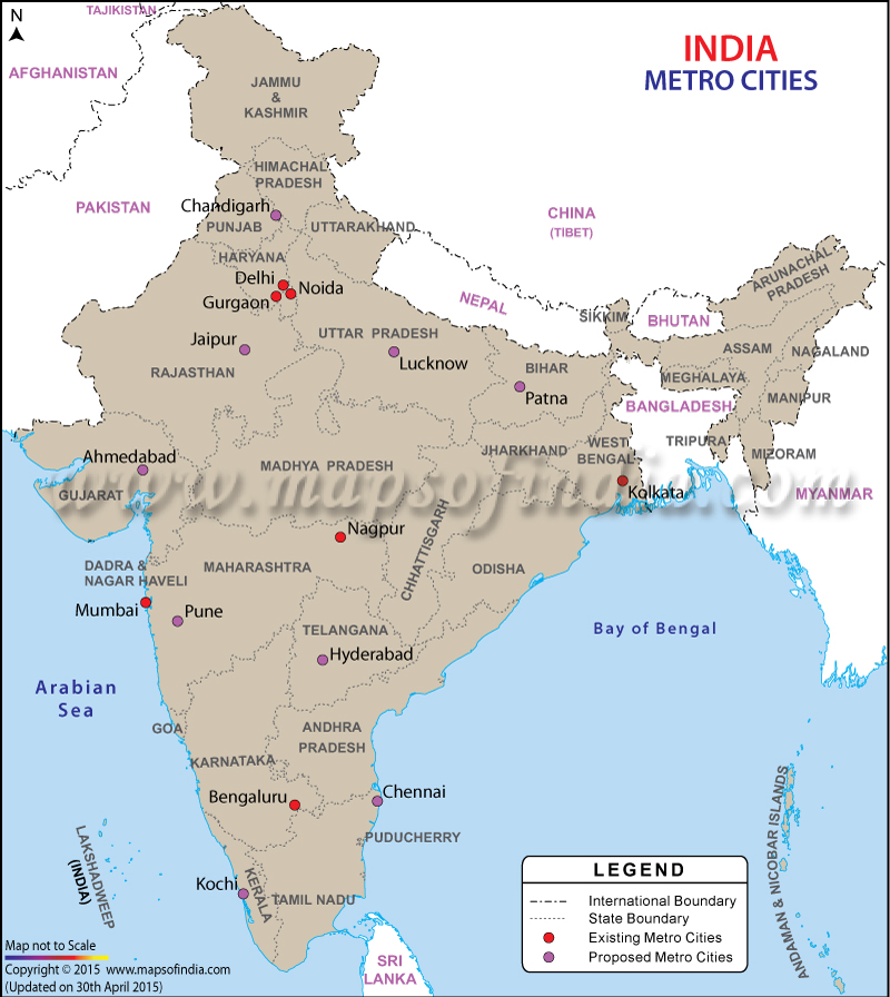
| *Map showing Metro Cities Map |
| Disclaimer: All efforts have been made to make this image accurate. However Mapping Digiworld Pvt Ltd and its directors do not own any responsibility for the correctness or authenticity of the same. |
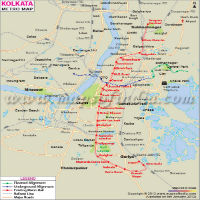
The metro trains are high-capacity public transports which are generally seen in urban areas. They are electric railways which operate on right-of-way and cannot be accessed by pedestrians or any other vehicle. The metro services work on designated lines and run between stations using electrical units on railway tracks. Some metros also run underground services. The first metro in India, Kolkata Metro, began its operations in 1984. The Delhi Metro is the first metro with the modern system and began its operations in 2002. It is the third metro with rapid transit system after Kolkata and Chennai rapid metro system.
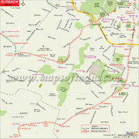
The operations for the first privately-owned and operated Rapid Metro Rail of Gurgaon began in November 2013. Currently, the metro services are operating in a very few cities, but the number is likely to rise in future with the metro projects underway in many cities.
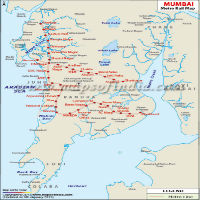
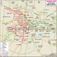
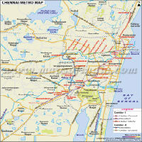
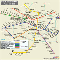
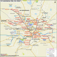
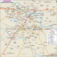
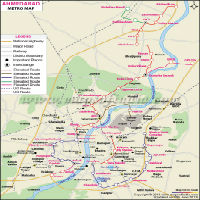
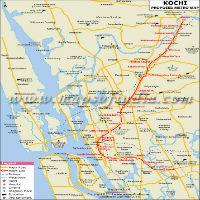
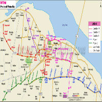
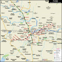
Here, you can find the maps for both currently functional and upcoming metros in different cities of the country. You can enlarge the map by clicking on a particular city's map. The map explains the detailed information about the metro routes in the concerned city. It describes the presently functional and the proposed routes. The routes also specify the names of the metro stations that fall under them.
| Metro Name | City | State |
|---|---|---|
| Kolkata Metro | Kolkata | West Bengal |
| Chennai MRTS | Chennai | Tamil Nadu |
| Delhi Metro | Delhi | Delhi |
| Namma Metro | Bengaluru | Karnataka |
| Rapid Metro Rail | Gurgaon | Haryana |
| Mumbai Metro | Mumbai | Maharashtra |
| Jaipur Metro | Jaipur | Rajasthan |
| Kochi Metro | Kochi | Kerala |