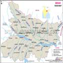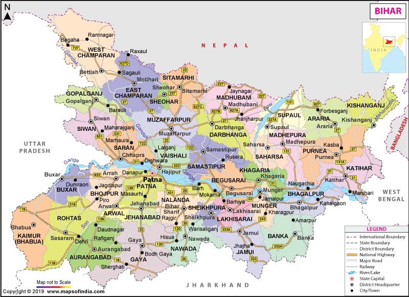
| Map showing major roads, railways, rivers, national highways, etc. |
| Disclaimer: All efforts have been made to make this image accurate. However Mapping Digiworld Pvt Ltd and its directors do not own any responsibility for the correctness or authenticity of the same. |
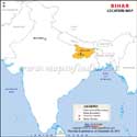
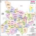
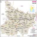
Located in the eastern part of India, Bihar is the 13th largest state of the country. The state covers an area of 94,163 square km. On 15 November 2000, the southern part of Bihar was split to form the state of Jharkhand. Bihar is divided into 37 districts and has Patna as its capital.
The state has a rich history and culture which dates back to ancient times. It was once a great center of learning and many a powerful empires originated from here. It was also the centre of Buddhism as the religion originated from here. During the Mahajanpadha era, Magadha was one of the 16 kingdoms that existed in ancient India. But, it soon came to encompass the other kingdoms and by the time of Mauryas, especially Ashoka who was the greatest Emperor of India, its extent has spread to include parts of Iran and Afghanistan.
Located in Gaya, Bodh Gaya is associated with the revered sage Buddha as it was here that he gained enlightenment under the Bodhi Tree.Some prominent universities of ancient Bihar were Nalanda Odantapurā and Vikramashila. During the medieval ages, Bihar went into decline. Following the battle of Buxar, Bihar passed under the British rule and became a part of Bengal Presidency. In 1912, Bihar, along with Orissa became a separate province. Following India's independence in 1947, it became a part of independent India.
Today, Bihar has one of the fastest growing economies in terms of gross state domestic product. Mainly an agricultural economy, the state is the largest producer of vegetables in the country. It also holds the distinction of being the country's second largest producer of fruits. The state has also made progress in the industrial sector with an oil refinery in Barauni and a power plant in Muzaffarpur. A satellite town located in the Patna Metropolitan Region, Fatuha is a well known for its farm tractor and scooter industries. Other than this, Bihar is also known for its agriculture-based industries such as sugar and vegetable oil and its famous mines at Dhanbad.
Bihar is a fascinating tourism destination and is known for its monuments and relics dating from the ancient to the medieval times. Some treasures worth visiting in the state are the Tomb of Sher Shah Suri, Barabar Caves, Vikramshila Monastery, Buddha Smriti Park, ruins of the ancient city of Vaishali, Bodhi Tree and the Mahabodhi Temple. Takht Sri Patna Sahib was built by Maharaja Ranjit Singh in honour of Guru Gobind Singh Ji who was born in Patna.
The official languages of the state are – Hindi and Urdu. The other languages that are spoken by people in the state are Bhojpuri, Maithili, Magahi, Bajjika, and Angika (0.7 million). Of these other languages, the government of India recognises only Maithili.
Bihar is home to many educational institutes. Some prominent educational institutes in the state are National Institute of Technology, Indian Institute of Technology, Indian Institute of Management, National Institute of Fashion Technology, and AIIMS. Some other prime institutes are Aligarh Muslim University, Aryabhatta Knowledge University, Bihar Agricultural University, B. R. Ambedkar Bihar University, Mahatma Gandhi Central University, and Patna University, to name a few.
Bihar State Information |
|
|---|---|
| Capital | Patna |
| Date of formation | 26. Jan. 1950 |
| Governor | Ram Nath Kovind |
| Chief Minister | Nitish Kumar |
| Tourist attractions | Rajgir, Nalanda, Vaishali, Pawapuri, Bodh Gaya, Vikramshila, Gaya, the ancient city of Patliputra |
| Festivals | Chatth Puja, Sama-Chakeva, Nag Panchami |
| Major dance and music forms | Jat-Jatin dance of the Mithila region, Bidesia, the songs of Vidyapati, Chau Tribal dances |
| Arts and crafts | Madhubani painting; Madhubani's marsh `sikki. grass is used to make baskets, toys, dolls etc; Sujini kantha embroidery is a specialisation of Bihar. |
| Languages | Hindi, Urdu, Santhali |
| Size | 94,163 sq. km |
| Population (Census 2011) | 104,099,452 |
| Rivers | Kosi, Ganga, Saryu, Gandak, Kamla, Panar, Saura, Pun-pun |
| Forests and wildlife sanctuaries | Valmiki NP, Rajgir WS, Bhimbandh WS, Gautam Buddha WS, Udayapur WS |
| State animal | Gaur |
| State bird | Indian rollAt., |
| State flower | Kachnar |
| State tree | Peepal |
| Major crops | Paddy, wheat, maize |
| Factoids | A peepal or Bodhi tree in Bodh Gaya marks the spot where the Buddha achieved Enlightenment. |
| Nalanda University, a seat of Buddhist learning, was founded around the 5th century AD. | |
| No. of District | 38 |
| Places to visit in Bihar | Places to visit in Bodhgaya | Places to visit in Nalanda |
| Places to visit in Patna | Places to visit in Rajgir | Places to visit in Vaishali |
| Bhagalpur Hotels | Bodhgaya Hotels | Gaya Hotels |
| Forbesganj Hotels | Katihar Hotels | Patna Hotels |
| Purnia Hotels | Rajgir Hotels |