
| Disclaimer: All efforts have been made to make this image accurate. However Mapping Digiworld Pvt Ltd and its directors do not own any responsibility for the correctness or authenticity of the same. |
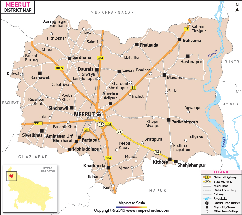
nomenclature of Meerut District is shrouded in conjectures and surmises. It is generally assumed that Ravana's father-in-law, Maya, christened the district formerly known as Maidant-ka-Khera. Occupying an area of 2521.6 sq. km, Meerut spans across the coordinates 28°98' North latitude to 77°0 7' East longitudes.
With a population count of 34,47,405 Meerut possesses a distinctly agrarian economy coupled with a few industries.
Meerut, with its imminent history and luxuriant picturesque backdrop has a well-developed tourism sector. The notable tourist destinations include:
| Facts of Meerut District | |
|---|---|
| State | Uttar Pradesh |
| District | Meerut |
| District HQ | Meerut |
| Population (2011) | 3443689 |
| Growth | 14.89% |
| Sex Ratio | 886 |
| Literacy | 72.84 |
| Area (km2) | 2522 |
| Density (/km2) | 1342 |
| Tehsils | Mawana, Meerut, Sardhana |
| Lok Sabha Constituencies | Meerut |
| Assembly Constituencies | Hastinapur, Kithore, Meerut, Meerut Cantt., Meerut South, Sardhana, Siwalkhas |
| Languages | Hindi, Urdu, Punjabi |
| Rivers | Ganga |
| Lat-Long | 28.960089,77.836532 |
| Travel Destinations | Jain Temples, St. John'S Church, Augarnath Temple, Jama Masjid, Martyr'S Memorial, Gandhi Bagh, Shahpeer'S Mausoleum, Shahi Eid Gaah, Parikshitgarh, Dargah Of Baley Miyan, Suraj Kund etc. |
| Government Colleges/Universities | A.S. College, Aadharshila College Of Education, Deewan Law College, Esar College Of Engineering, Elite College Of Professionaal And Studies, Dav College, Dadhichi College Of Higher Edu., College Of Engg. And Raural Technology etc. |