
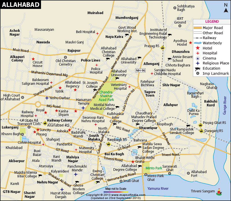
| *Allahabad city Map showing roads, hotels, hospitals and other places of interest. |
| Disclaimer: All efforts have been made to make this image accurate. However Mapping Digiworld Pvt Ltd and its directors do not own any responsibility for the correctness or authenticity of the same. |
Allahabad is a city in Uttar Pradesh and falls in the administrative headquarters of the Allahabad district. It is also known as 'Prayag', which means the place of offerings. It is the seventh most populous city of Uttar Pradesh and was ranked 130th fastest-growing city in the world in 2011. The metropolitan region of the city covers an area of 63.07 sq km and the population of the city as per Census 2011 is more than one million. The Allahabad district is located at 25° 26' N / 81° 50' E at an elevation of 98 m.
Allahabad is considered as a sacred place because the sacred rivers; namely, Ganges, Yamuna and Saraswati unite here. Being one of the oldest cities in the country, it houses many historical Hindu temples. 'Maha Kumbh Mela' is the biggest religious event organised in Allahabad after every 12 years in which Hindus gather to bathe in a sacred river as it is believed that when Lord Vishnu, embodied as Mohini, was flying away with Amrita (the nectar of immortality), he spilled four drops of it at four places: Allahabad, Haridwar, Nashik and Ujjain. Thus, this mass Hindu pilgrimage of faith started. It is reckoned as the largest peaceful gathering in the world. The event is the main attraction of the city and draws numerous pilgrims and tourists. Apart from that, Allahabad Fort, Thornhill Mayne Memorial, Khusro Bagh and Jawahar Planetarium are some of the tourist attractions in the city.
Allahabad is also called the 'City of Prime Ministers' as many Indian prime ministers belong to the city. They were either born there or had studied at Allahabad University or were elected from the Allahabad constituency. Some of those prime ministers were Jawaharlal Nehru, Gulzarilal Nanda, Lal Bahadur Shastri, Indira Gandhi, Rajiv Gandhi and Chandra Shekhar.
Agriculture is the main industry of the city and crops like pigeon peas (arhar), pearl millet (bajra), green gram (moong) and black gram (urd) have a great amount of share in the industry. More than 10,000 unregistered small scale industries are present in the city that contribute to its economy. The city also houses many educational institutions.
Allahabad Airport or Bamrauli Airport connects Allahabad to other major cities in the country. Other nearest airports are in Varanasi, Kanpur and Lucknow. It is well-connected through railways to other parts of India. The city has many railway stations such as Chheoki, Naini, Allahabad City, Allahabad Junction, Bamrauli, Subedarganj and others. The Uttar Pradesh State Road Transport Corporation plies regular buses connecting Allahabad to the other cities of Uttar Pradesh.
WBST210315
WBVDA