
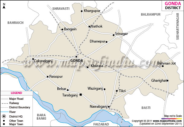
| *The Map showing the National Highway, Major roads, other Roads, District Headquarter, Town, etc in the Gonda District, Uttar Pradesh |
| Disclaimer: All efforts have been made to make this image accurate. However Mapping Digiworld Pvt Ltd and its directors do not own any responsibility for the correctness or authenticity of the same. |
Gonda district is one of the important districts of Uttar Pradesh which have a global location between north latitude 26° 47' to 27° 20' and east longitude 81° 30' to 82° 46'.
The total geographical area of the district is 4448sq.km.and a population of 34,31,386. The district has its headquarters in the town of Gonda.
Gonda is blessed with several lakes like Banka, Kodar, Aranga and rivers like Kuwana, Bisuhi and Manwar.
There is no dearth of tourist places in Gonda. Few of the several important destinations are Varahi Devi, Prash and Paska.
| Facts of Gonda District | |
|---|---|
| State | Uttar Pradesh |
| District | Gonda |
| District HQ | Gonda |
| Population (2011) | 3433919 |
| Growth | 24.17% |
| Sex Ratio | 921 |
| Literacy | 58.71 |
| Area (km2) | 4425 |
| Density (/km2) | 857 |
| Tehsils | Colonelganj, Gonda, Mankapur, Tarabganj |
| Lok Sabha Constituencies | Gonda, Kaiser ganj(partial) |
| Assembly Constituencies | Colonelganj, Gaura, Gonda, Katra Bazar, Mankapur, Mehnaun, Tarabganj |
| Languages | Hindi, Awadhi |
| Rivers | Ghaghara |
| Lat-Long | 27.039557,81.951714 |
| Travel Destinations | Swami Narain Temple, Varahi Dev, Prash, Tirrey Manorama, Prithvi Nathan Mahadeo, Jhali Dham, Parvati Mahadeo etc. |
| Government Colleges/Universities | Meena Shah Degree College, Baba Gayadeen Vaidya Babu Ram Mahavidyalaya, Kisan Degree College, Bhagirathi Singh Memorial Mahavidyalaya, Chandra Shekhar Shyamraji Mahavidyalaya, Dashrath Singh Memorial Mahavidyalay, Dr. Bheem Rao Ambedkar Mahavidyalaya, Hakikullah Chaudhary Mahavidyalaya, Kamta Prasad Mathura Prasad Janta Mahavidyalaya etc. |