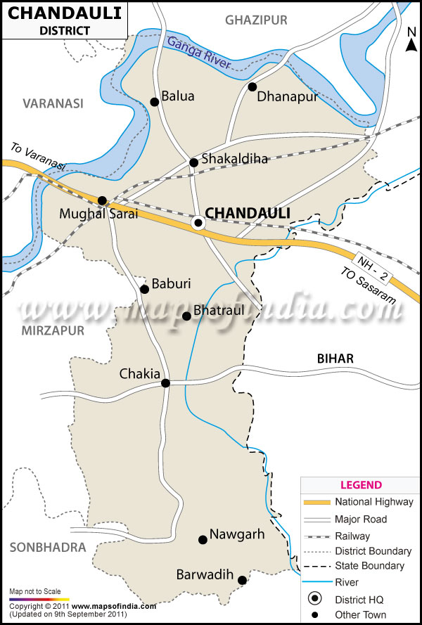
*The Map showing the National Highway, Major roads, other Roads, District Headquarter, Town, etc in the Chandauli District, Uttar Pradesh
Disclaimer: All efforts have been made to make this image accurate. However Mapping Digiworld Pvt Ltd and its directors do not own any responsibility for the correctness or authenticity of the same.
Chandauli is a district situated in the state of Uttar Pradesh, India. It falls under the Varanasi Division of the state.
The district of Chandauli covers an area of 2,485sq.km. Total population in the district of Chandauli is 24, 16,617. The district has its headquarters in Chandauli.
Facts of Chandauli District
State
Uttar Pradesh
District
Chandauli
District HQ
Chandauli
Population (2011)
1952756
Growth
18.83%
Sex Ratio
918
Literacy
71.48
Area (km2)
2554
Density (/km2)
768
Tehsils
Chakia, Chandauli, Sakaldiha
Lok Sabha Constituencies
Chandauli
Assembly Constituencies
Chaika, Mughalsarai, Sayidaraja, Sakaldiha
Languages
Hindi, Urdu
Rivers
Ganga, Karmanasha, Chandraprabha
Lat-Long
25.182573,83.292446
Travel Destinations
Chandraprabha Lake, Bhaisoda Lake, Naugarh Lake, Mushakhard Lake, Latifshah Lake, Rajdari Waterfall, Devdari Waterfall, Aurvatard Waterfall, Karmanasha Waterfall, Chandraprabha Wildlife Sanctuary etc.
Government Colleges/Universities
Pt. Ramadhar J.Tiwari College Of Polytechnic, Maa Bhawani P G Collage, Haji Muhammd Ayub Memoriyl Inter College, Balmiki Inter Collage, Shri Saraswati Inter College etc.