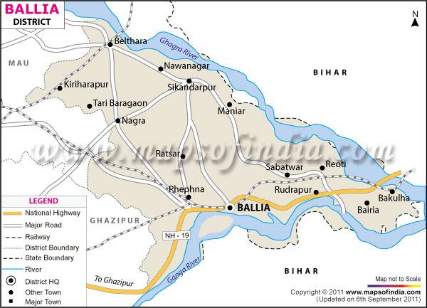
*The Map showing the National Highway, Major roads, other Roads, District Headquarter, Town, etc in the Ballia District, Uttar Pradesh
Disclaimer: All efforts have been made to make this image accurate. However Mapping Digiworld Pvt Ltd and its directors do not own any responsibility for the correctness or authenticity of the same.
Ballia district stretches from 83?38' to 84?39' East longitudes and 25?33' to 26?11' North latitudes. As per the census of 1991, the total population of the district was 22, 62,273. The district occupies a geographical area of 3168 sq. km
Agriculture, glass and ceramics, horticulture, sugar industry, manufacturing of mechanical equipments, and a variety of small-scale industries share the economic map of Ballia.