
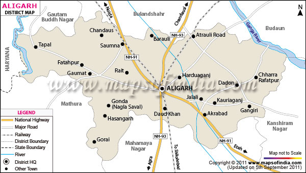
| *The Map showing the National Highway, Major roads, other Roads, District Headquarter, Town, etc in the Aligarh District, Uttar Pradesh. |
| Disclaimer: All efforts have been made to make this image accurate. However Mapping Digiworld Pvt Ltd and its directors do not own any responsibility for the correctness or authenticity of the same. |
Aligarh district of Uttar Pradesh has the total area of 3700.4 Sq. km. According to 2001 census the total population is 667,732. The district lies on the plains of river Ganges and Yamuna. The prestigious Aligarh Muslim University is situated at Aligarh district.
Locks and brass articrafts are manufactured in Aligarh district. The locks of Aligarh is so famous that it is known as 'Tala Nagri'. The district even exports Brass Artwares, Glass Beeds and other electrical items to different industries of the world.
Tourists come to Aligarh to visit Jama Masjid of Aligarh and Aligarh Fort.
| Facts of Aligarh District | |
|---|---|
| State | Uttar Pradesh |
| District | Aligarh |
| District HQ | Aligarh |
| Population (2011) | 3673889 |
| Growth | 22.78% |
| Sex Ratio | 882 |
| Literacy | 67.52 |
| Area (km2) | 3747 |
| Density (/km2) | 1007 |
| Tehsils | Koil, Khair, Atrauli, Iglas, Gabhana |
| Lok Sabha Constituencies | Aligarh |
| Assembly Constituencies | Aligarh, Atrauli, Barauli, Chharra, Iglas, Khair, Koil |
| Languages | Hindi & Urdu |
| Rivers | --- |
| Lat-Long | 27.900383,78.079734 |
| Travel Destinations | Aligarh Fort, Chacha Nehru Gyan Pushp, Naqvi Park, The Mangalayatan, Jama Masjid etc. |
| Government Colleges/Universities | Aligarh Muslim University, Mangalayatan University, Jawaharlal Nehru Medical College, Sir Ziauddin Dental College, Abdulla Girls College, Azmal Khan Tibiya College, D S College, S V College, Tikaram Girls College etc. |