
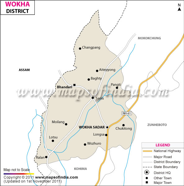
| *The Map showing major roads, national highways, boundaries, headquarter and major towns of Wokha district, Nagaland. |
| Disclaimer: All efforts have been made to make this image accurate. However Mapping Digiworld Pvt Ltd and its directors do not own any responsibility for the correctness or authenticity of the same. |
Wokha is one of the districts of the northeastern state of Nagaland. This town is the renowned abode of the ancient people called the Lothas. The headquarters of the Wokha district is located in the town of Wokha.
This district was formed in the year 1973 and encompasses a net area of 1,682 square km. The altitude of this district of Nagaland is 1,313.69 meters. Wokha extends between 26.1° N Latitude and 94.27° E Longitude. According to the Census report of 2001, the total population of this district is 1, 61,098.
The topography of the district of Wokha is quite similar to that of Tuensang District. The place has a number of ridges and hills. The district is bordered by Kohima towards the south, Mokokchung towards the north, Assam towards the west and Zunheboto towards the east. The Wokha district is located in the western region of the state of Nagaland. It lies close to the plains of Sibsagar in the state of Assam.
The three main ranges of Wokha are the Upper Range or the Wokha Range, the Lower Range or the Bhandari Range and the Middle Range or the Sanis Range. The tallest peak is the Tiyi Enung, which has a height of 1970 meters.
The district of Nagaland is well known in the state for a variety of fruits like oranges, bananas and plums that are available here. This place also produces bamboo shoots and vegetables.
This district has a number of major attractions, which are as follows: