
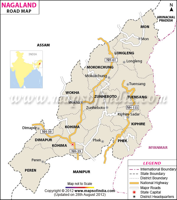
| *Map showing entire road network of Nagaland. |
| Disclaimer: All efforts have been made to make this image accurate. However Mapping Digiworld Pvt Ltd and its directors do not own any responsibility for the correctness or authenticity of the same. |
Nagaland has a road network of 9860 kms. As many as 900 villages in the state are connected by roads. In the absence of a well developed railway and air network, Nagaland relies heavily on its road network. Dimapur is the only city in the state of Nagaland to have a railway station and an airport.
The state of Nagaland is divided into 11 districts. MapsofIndia brings you the road map of 8 districts of Nagaland. These include: