
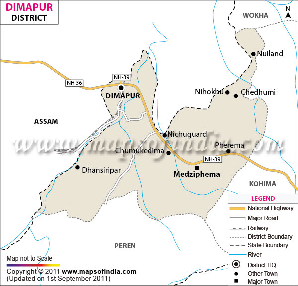
| *The Map showing major roads, national highways, boundaries, headquarter and major towns of Dimapur district, Nagaland. |
| Disclaimer: All efforts have been made to make this image accurate. However Mapping Digiworld Pvt Ltd and its directors do not own any responsibility for the correctness or authenticity of the same. |
Dimapur became a part of the administrative districts of Nagaland in December, 1997 when the district was carved out of Kohima District. With its administrative headquarters situated in the town of Dimapur, the district is reputed as the commercial center of the state of Nagaland.
Dimapur district is bound on the east and the south by the district of Kohima and by the state of Assam on the west. The district of Dimapur occupies a total area of 927 square kilometers. The district is located in the geographical coordinates of 93° 44' 30" East longitude and 25° 54' 45" North latitude. According to the census conducted in the year 2001, the population of the state was determined to be 3, 08,382. The district is chiefly inhabited by the Naga tribes. Ruins of the Kachari kingdom are reminiscent of the glorious rule of the emperors of Kachari. The district derives its name from the Kachari dialect, where Dimapur refers to the city that rests along the banks of the great river. With the well developed infrastructure, the district forms the gateway to the north eastern states of the country. The only airport of the state of Nagaland is situated in the district of Dimapur. Various airlines serve the state connecting it to the metropolitan city of Kolkata. The district is also well connected by railways to some of the major cities of the country. The National Highway 39 connects the district to the border town of Moreh as well.
The salubrious climate of the district is suitable for the people of the state and its visitors.