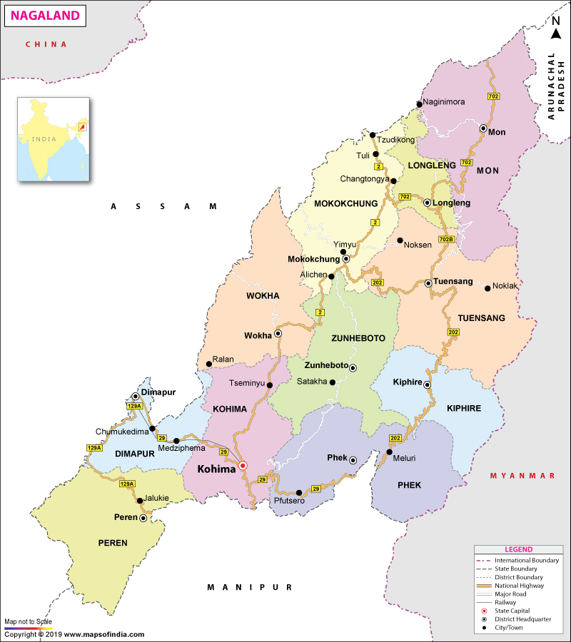
| *Map of Nagaland with major roads, railways, rivers, national highways, etc. |
| Disclaimer: All efforts have been made to make this image accurate. However Mapping Digiworld Pvt Ltd and its directors do not own any responsibility for the correctness or authenticity of the same. |
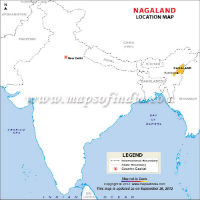
Nagaland is one of the northeastern states in India. It is bordered on its west and north by Assam, on its east by Myanmar (formerly known as Burma), on its north by Arunachal Pradesh, and on its south by Manipur.
Nagaland is one of India's smallest states, with a total area of 16,579 sq km (6400 sq mi). The Naga Hills run through this small state, which has Saramati as its highest peak at a height of about 12,600 ft. Dhansiri, Doyang, Dikhu and Jhanji are the rivers that flow through this state. The terrain is mountainous, thickly wooded, and cut by deep river valleys. There is a wide variety of plant and animal life. Nagaland has a monsoon climate with generally high humidity; rainfall averages between 1800 to 2500 mm (70 to 100 inches) a year.
| Facts on Nagaland | |
|---|---|
| Official Website | www.nagaland.nic.in |
| Date of Formation | 1 December 1963 |
| Area | 16,579 sq km |
| Density | 119/km2 |
| Population (2011) | 1978602 |
| Males Population (2011) | 1024649 |
| Females Population (2011) | 953853 |
| Ratio of Urban Population (2011) | 28.86% |
| No. of District | 11 |
| Capital | Kohima |
| Rivers | Doyang, Dikhu, Dhansiri, Chubi |
| Forests & National Park | Intanki NP, Rangapahar WS, Fakim WS, Puliebadze WS |
| Languages | Nagamese, Creole, Assamese, English |
| Neighbours State | Arunachal Pradesh, Assam, Manipur |
| State Animal | Mithun |
| State Bird | Blyth's Tragopan |
| State Tree | Alder |
| State Flower | Kopou |
| Net State Domestic Product (2011) | 52643 |
| Literacy Rate (2011) | 73.45% |
| Females per 1000 males | 931 |
| Assembly constituency | 60 |
| Parliamentary constituency | 1 |
Nagaland has a single-chamber Legislative Assembly with 60 seats. The state sends two members to the Indian Parliament: one to the Rajya Sabha (Upper House) and one to the Lok Sabha (Lower House). There are seven local government administrative districts - Mokokchung, Tuensang, Mon, Wokha, Zunheboto, Phek and Kohima.
The state is located between the 93°20' E and 95°15' E Longitudes and 25°6' and 27°4' N Latitudes. The total area covered by the state is 16,579 square km. Nagaland was declared the 16th state of the country of India on 1 December 1963. Prior to this, Nagaland used to be a union territory. The other interesting information about Nagaland is that it houses as many as 16 different ethnic groups. These groups of people have their own separate cultural identities which include customs, dresses and languages. Almost 90% of the population of Nagaland is devout Christians. The state also has a substantial Hindu populace.
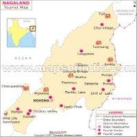
Speaking about Nagaland's climate, it can be said that the state has quite a pleasant weather all through the year. The bracing weather makes it one of the most popular tourist spots in the Indian subcontinent. Some of the tourist attractions of the state are:
State Museum
Kohima, the capital city of the state, has a number of sites which must be visited by the tourists as it will help them in getting an insight of the rich history place. The name 'Kohima' has been derived from the name of a plant called 'Kew Hi', which thrives in the mountainous region. Kohima is a fascinating place, endowed with a lot of natural beauty. The Nagaland capital can be easily accessed by all the major means of transportation. The nearest airport is located at Dimapur at a distance of 74 kms. The World War II Cemetery that lies in a beautiful surrounding, the Cathedral of Reconciliation with its striking red roof, the Bara Basti, the Nagaland Museum, Nagaland Zoo and Park are some of the attractions of Kohima.
The sites near Kohima include the tribal village of Khonoma, Dzulekie (famous for waterfalls), Japfu Peak, Dzukou Valley, Dimapur, etc.
Not much is known about the early history of Nagaland, which include the origin of several large sandstone pillars at Dimapur. British rule was established over the area by the 1890s, and headhunting, then a traditional practice, was outlawed. The Naga territory remained split between Assam and the North East Frontier Agency after Indian independence in 1947, despite a vocal movement advocating the political union of all the Naga tribes; one faction called for secession from India. In 1957, following violent incidents, the Indian government established a single Naga administrative unit under Indian rule. The Naga people responded by refusing to pay their taxes and by conducting a campaign of sabotage. In 1960 the Indian government agreed to make Nagaland a self-governing state within India; the state was officially inaugurated in 1963.
A study of the geography of Nagaland denotes the topographical features of northeast Indian state. Located in the northeastern region of India, the state of Nagaland shares the international border with the country of Myanmar. The state lies between the geographical coordinates of 25°6' and 27°4' north latitudes and 93°20' and 95°15' east longitude. At least 16 different tribes live in Nagaland, each of them having their distinct customs, attires, languages and dialect.
The Nagas, inhabitants of Nagaland, are said to belong to the indo-mongoloid stock, a race whose presence was first noted ten centuries before Christ, at the time of the compilation of the Vedas. The Nagas form more than 16 tribes, as well as numerous subtribes, each having a specific geographic distribution. Though sharing many cultural traits, these tribes have maintained a high degree of isolation and lack cohesion as a single people. The Konyaks are the largest tribe, followed by the Aos, Tangkhuls, Semas, and Angamis. Other tribes include the Lothas, Sangtams, Phoms, Changs, Khiemnungams, Yimchungres, Zeliangs, Chakhesangs (Chokri), and Rengmas. The principal languages are Angami, Ao, Chang, Konyak, Lotha, Sangtam, and Sema.
The government departments of Nagaland are engaged in the work of administering and managing the different departments of the state government so that the state runs efficiently. The state government comprises many departments that are headed by the elected ministers of Nagaland. These government departments are integral part of the government and politics of the state. Some of such government departments are as follows:
The population of the state is about two million people and the population has decreased during 2001-2011. The decadal growth rate of the state 2001-2011 is -0.58%. The number of females per males in the state is 931. With a total area of 16,579 sq km, the density of population of the state is 119. Majority of the population lives in the rural areas and the literacy rate of the state is 80.11%.
The language diversity existing in Nagaland can not be found in any other state in India. Naga people speak as many as 36 different languages and dialects. Besides Nagamese, there are many languages which the people of the state speak. These languages come under the Tibetan-Burmese group of language and are classified into three parts - Western, Central and Eastern Naga groups.
The media of Nagaland, like media in any other place, is an important component of the state. The Indian state of Nagaland has a somewhat isolated location but the media makes sure that all kinds of news, both national and international reach the people of the state. Media of this state include television, radio and newspapers. The state has an access to almost all the Indian news, entertainment and sports channels and is therefore well-connected to the rest of the nation. The newspaper media in Nagaland is the broadest and besides the national newspapers of India, a number of newspapers are published from the state itself.
About 90 percent of the people of Nagaland are dependent on Agriculture. Rice and corn are the main crops. However, the state is not self-sufficient in food. Shifting cultivation (also known as slash-and-burn agriculture) is widely practiced. Food needs have caused the fallow, or idle, period to be cut to a couple of years, causing erosion and a loss of soil fertility and crop yields. The forests, which cover about 17 percent of Nagaland, are its most important source of income. There are varied mineral reserves, including oil deposits, but little exploitation. The state has adopted an industrialisation program since the 1970s. Until the early 1970s, only cottage industries (e.g., weaving, woodwork, basketry, and pottery) existed in the state. Lack of raw materials, financial resources, power, poor transport and communications all hindered industrial growth.
As per census 2011, the state has a literacy rate of 80.11%. The state government looks after the primary, elementary and secondary education and the children below the age of 14 years are entitled to 'free education'. The schools are mainly affiliated to the Nagaland Board of Secondary Education (NBSE) and some of the schools are affiliated to the CBSE Board. There are many colleges in the state which offer courses in different streams such as arts, science and commerce. There are also some educational institutions which offer professional or higher education in the fields of engineering, law and management.
The state of Nagaland, one of the major tribal regions in the country of India, is visisted by people from around the world for its quaint hills, cascading waterfalls, green carpeted valleys, dense forests and rich wildlife, all of which create a pristine environment.
Location of NagalandThe state is geographically located at 25.67° N and 94.12° E in northeast India.
The state of Nagaland is easily connected to the other parts of India by air, rail and roadways. Connectivity through railways is minimal though. The best way to reach this state is by roadways because of its proximity to a number of national as well as state highways. Most of the important villages and towns are served by the Nagaland State Transport Services, which even runs deluxe night buses from the city of Dimapur to Mokokchung, Guwahati and Shillong. Besides, tourists can even hire an entire or shared yellow taxi as well as a rented car to move in and around the state. Dimapur railway station on the North East Frontier Railway is the main railway station of the state that connects it to Guwahati, which has got direct trains to some of the most important cities of India. Dimapur Airport is the sole airport of the state. Direct flights ply to and from that airport to the cities of Guwahati and Kolkata.
This land of tribes attracts tourists for its natural beauty, pollution free environment, lovely landscapes and incomparable cultural heritage. The below mentioned table provides names of some of the location wise tourist attractions in Nagaland:
| Location | Tourist Places |
|---|---|
| Dimapur | Diezephe Craft Village |
| Rangapahar Reserve Forest | |
| Ruins of the Kachari Kingdom of the medieval age. | |
| Kiphire | Fakim Wildlife Sanctuary |
| Geysers and twin stones of Salomi and Mimi | |
| Mihki (River of Salt) | |
| Siphi Stone Monolith | |
| Sukhayap Cliff | |
| Wawade Waterfall | |
| Yimgphi Village | |
| Village Caves | |
| Kohima | Catholic Cathedral |
| Cemetery of World War II | |
| Dzukou Valley (Famous for camping and trekking) | |
| Khonoma Heritage Museum and Crafts Centre | |
| State Museum | |
| Zoological Park | |
| Mokokchung | A. K. M. Monument |
| Chuchuyimlang Village | |
| Langpanglong Village | |
| Longkhum Village | |
| Longritzu Lenden Valley | |
| Molung Village | Mongzu Ki and Fusen Kei caves |
| Mopongchuket Village | |
| Tangkum Marok Spring | |
| Mon | Chui Village |
| Langmei Village | |
| Longwa Village | |
| Naganimora Village | |
| Shangnyu Village's local museum and stone monoliths | |
| Veda Waterfall and Peak | |
| Peren | |
| Benreu Village | |
| Mt. Pauna (Stone carvings and tourist village) | |
| Phek | Chizami Village |
| Khezakenoma Village | |
| Pfutsero Village | |
| Poruba Village | |
| Ruzhazho Village | |
| Suthazu Village | |
| Thetsumi Village | |
| Weziho Village | |
| Yurba Village | |
| Zhavame Village | |
| Dzudu Lake | |
| Glory Peak | |
| Shilloi Lake | |
| Zanibu Peak | |
| Tuensang | Changsangmonko Village |
| Chilise Village | |
| Stones of Chungliyangti, Tsadang and Tsongliyangti | |
| Wokha | Doyang River |
| Mt. Tiyi | |
| Totsu Cliff | |
| Valley and Lagoons | |
| Zunheboto | Aizuto (Forest, Lake and Village) |
| Ghosu Bird Sanctuary | |
| Satoi Range | |
| Sumi Naga Villages |