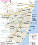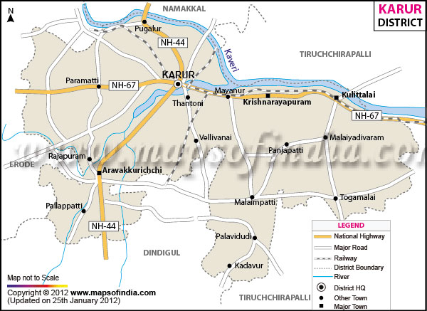
| *The Map showing the National Highway, Major roads, other Roads, District Headquarter, Town, etc in the Karur District, Tamil Nadu |
| Disclaimer: All efforts have been made to make this image accurate. However Mapping Digiworld Pvt Ltd and its directors do not own any responsibility for the correctness or authenticity of the same. |
Karur is located between 11 degree 00' and 12 degree 00' North of Latitudes and between 77 degree 28' and 78 degree 50' East of Longitudes. It is spread over an area of 2,895.57 Sq. km. And the total population of the district is 9,35,686, out of which 4,65,538 are males and 4,70,148 are females.
Farmers of the district of Karur are mainly engaged in the cultivation of Rice. Other crops grown in the region are millets, cereals, pulses, sugarcane, groundnut, and cotton. The major industries of the region are paper, bus body building and cement industries. A very common cottage industry is handloom industry engaged in the export of bed sheets, towels, floor rugs, tea towels, napkins, aprons, kitchen towels, pot holders, bathmats, tea mats, curtains, quill covers, shower curtains etc. People from far off places come to visit the Pasupatheesvarar Temple at Karur, built by the chola kings in the 7th century.