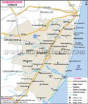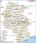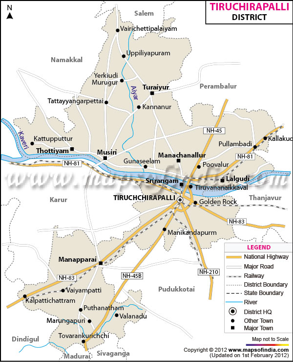
| *The Map showing the National Highway, Major roads, other Roads, District Headquarter, Town, etc in the Tiruchirappalli District, Tamil Nadu |
| Disclaimer: All efforts have been made to make this image accurate. However Mapping Digiworld Pvt Ltd and its directors do not own any responsibility for the correctness or authenticity of the same. |
Tiruchirappalli lies between 10 and 11 - 30' Northern Latitude and between 77 - 45' and 78 - 50' Eastern Longitude. The total area of the district is 4,403.83 Sq. km. As per 991 Census the total population of the district is 21,96,473, which accounts for 11,08,016 of the male population and 10,88,457 of the female population. The major crops of Tiruchirappalli district are rice, millets, cereals, pulses, sugarcane, groundnut, gingelly, and cotton.
Tiruchirappalli district is famous for: