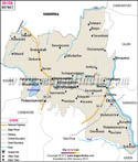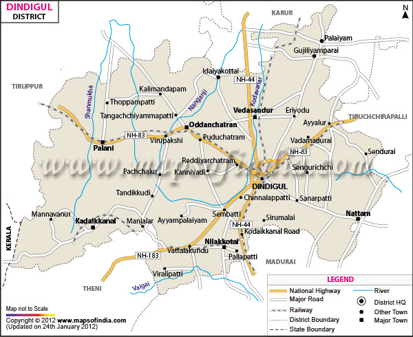
| *The Map showing the National Highway, Major roads, other Roads, District Headquarter, Town, etc in the Dindigul District, Tamil Nadu |
| Disclaimer: All efforts have been made to make this image accurate. However Mapping Digiworld Pvt Ltd and its directors do not own any responsibility for the correctness or authenticity of the same. |
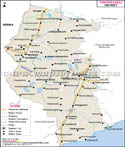
Dharmapuri district was formed on 2nd October 1965, covering an area of 4497.77 Sq. km, which is 3.46% of Tamil Nadu state. According to 2001 census, the total population of the district is 12,95,182, consisting of 6,70,520 males and 6,24,662 females. It lies between 11° 47' and 12° 33'North latitudes and 77° 02' and 78° 40' East longitudes.
The famous tourist places of Dharmapuri district are Hogenakal Falls, Shri Theerthagirishwarar Temple at Theerthamalai, Chenraya Perumal Temple at Adhiyamankottam, Subramanya Siva Memorial at Papparapatti.
The economy of the district is chiefly agrarian in nature and people are engaged in the cultivation of paddy, millets, pulses, and sugarcane. The district of Dharmapuri is a major horticultural belt in the state , which grows mango, coconut, and tamarind. Dharmapuri district is gifted with huge reserves of granite and quartz.