
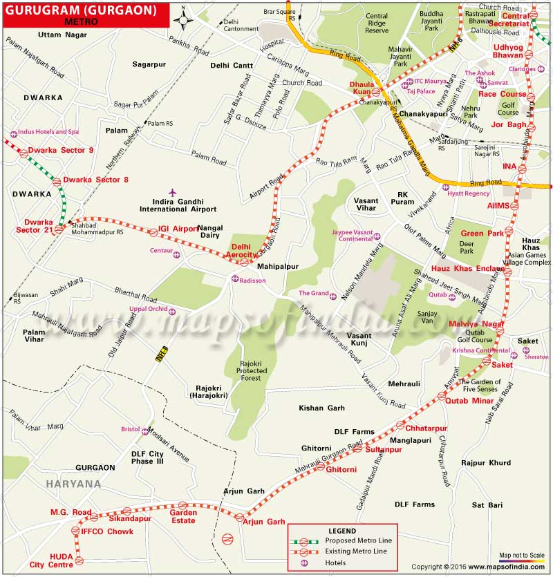
| *Gurgaon Metro map showing all the 10 operational Metro Stations from HUDA City Centre to Qutab Minar |
| Disclaimer: All efforts have been made to make this image accurate. However Mapping Digiworld Pvt Ltd and its directors do not own any responsibility for the correctness or authenticity of the same. |
Gurgaon is an IT hub in the Delhi/NCR and a large number of people travel to and from the city everyday for work. To provide hassle-free commutation and easy connectivity within Delhi and Gurgaon, on 21 June 2010, DMRC launched and started its operations to the Millennium City. The yellow line of the DMRC connects Gurgaon to Delhi via Chhatarpur metro station. The entire stretch of Chhatarpur-Gurgaon has an elevated layout. The total stretch of the yellow line is 45 kilometres and is one the busiest lines.
Chhatarpur - Sultanpur- Ghitorni - Arjan Garh - Guru Dronacharya - Sikandarpur - M G Road - IFFCO Chowk - HUDA City Centre
The Rapid Metro, which is linked with Delhi Metro's yellow line at Sikandarpur metro station, is a fully elevated metro system running within Gurgaon. The Rapid MetroRail Gurgaon Limited (RMGL) has constructed and is operating this metro system. The total length of this line is 5.1 km and comprises six stations. The fare for this metro is fixed at Rs. 20.
The minimum fare for Delhi-Gurgaon stretch is Rs. 8 and the maximum fare is Rs. 18.
DMRC has proposed a line which would link Delhi and Gurgaon. The proposed line is an extension of the Airport Express network and will connect Dwarka Sector 21 metro station to IFFCO Chowk metro station in Gurgaon. It is expected that with this new line the distance between Dwarka and IFFCO would be covered in only 14 minutes. The 12 km long stretch is expected to cost Rs. 1,830 crore.