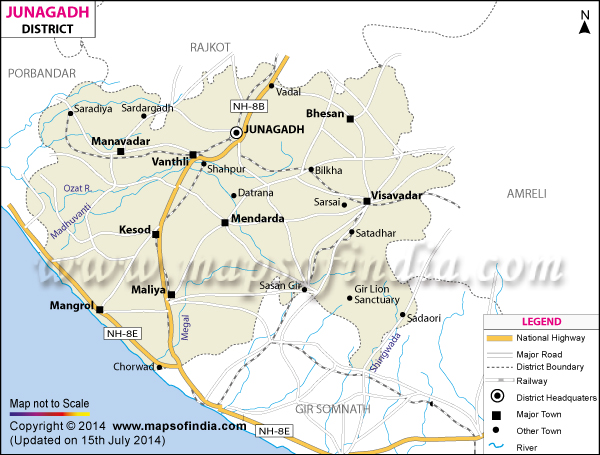
*Junagadh District Map highlights the National Highways, Major Roads, District Headquarter, etc. .
Disclaimer: All efforts have been made to make this image accurate. However Mapping Digiworld Pvt Ltd and its directors do not own any responsibility for the correctness or authenticity of the same.
Junagadh has a total of 8846 sq km of area. The place was formed as a separate district of Gujarat in the year 1960. Junagadh Agricultural University is one of the reputed educational institutes of the district. Uparkot Fort, Chorwad Beach, Gir Forest and Sanctuary, Ahmadpur Mandvi, Girnar Temple, Damodar, Maqbara are the special features of Junagadh district.