
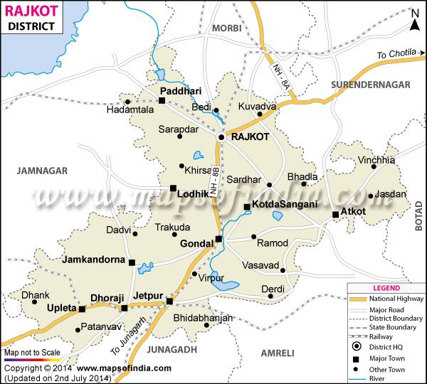
| *Rajkot District Map highlights the National Highways, Major Roads, District Headquarter, etc. |
| Disclaimer: All efforts have been made to make this image accurate. However Mapping Digiworld Pvt Ltd and its directors do not own any responsibility for the correctness or authenticity of the same. |
Rajkot, located in Gujarat is a center of commercial and industrial importance. It was founded by Vibhoji and used to be the capital of Saurastra. The Aji river flows through this district .
Rajkot is centrally located in the Kathiawar peninsula. It had a population of 18,00,000(2001 census). It has numerous primary schools, 5 Institutes of Technology, 90 high schools and 20 colleges. Rajkot is well connected by domestic airways, rail and road.
Rajkot is known as the birthplace of the Gandhian Non Violence movement. It is famous for manufacturing jewelry, woolen and cotton textiles, handicrafts and bandhni textiles. Places of tourist interest in Rajkot are the beautiful lakes around Aji Dam, Rashtriya Shala, Rajkumar college and the beautiful Jagat Mandir dedicated to Shri Shri Ramakrishna Paramahansa. The Tarnetar fair, which is yearly held here to celebrate the legendary marriage of Arjuna and Draupadi attracts many tourists.