| Facts of Moga District |
| State |
Punjab |
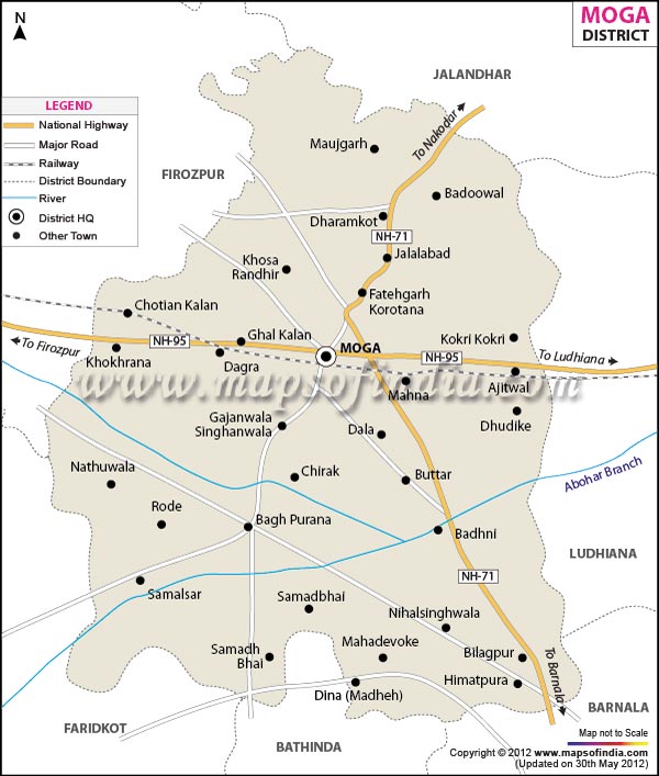
| District |
Moga |
| District HQ |
Moga |
| Population (2011) |
995746 |
| Growth |
0.00% |
| Sex Ratio |
893 |
| Literacy |
70.68 |
| Area (km2) |
2235 |
| Density (/km2) |
444 |
| Tehsils |
Bagha Purana, Moga, Nihal Singhwala |
| Lok Sabha Constituencies |
Faridkot (SC) |
| Assembly Constituencies |
Nihal Singh Wala (SC), Bhagha Purana Tehsil, Moga, Dharamkot |
| Languages |
Punjabi, Hindi |
| Rivers |
Sutleg |
| Lat-Long |
30.687526,75.244961 |
| Travel Destinations |
Dina Sahib Gurudwara, Geeta Bhawan, Kashmiri Park, Nehru Park, Shahidi Park etc. |
| Government Colleges/Universities |
Guru Nanak Govt. College, Government Polytechnic College, Lala Lajpat Rai Government College, Govt. Industrial Training Institute etc. |