About Arunachal Pradesh
History
People and Culture
Government
Economy
Pincode
STD Code
Governors
Chief Minister
Districts of Arunachal Pradesh
Lohit
East Siang
Tawang
Papum Pare
West Siang
Changlang
Arunachal Pradesh Map
Location Map
Physical Map
Mineral Map
Forest Map
Roads
Rivers
Tehsils
Cities in Arunachal Pradesh
Itanagar
Tawang
Naharlagun
Along
Ziro
Travel to Arunachal Pradesh
Palaces in Arunachal Pradesh
Museums in Arunachal Pradesh
Arunachal Pradesh Pilgrimage
Wildlife Sanctuaries
Namdapha National Park
Education
Engineering Colleges in Arunachal Pradesh
MBA Colleges in Arunachal Pradesh
Medical Colleges in Arunachal Pradesh
Universities in Arunachal Pradesh
Maps
Political Map
Physical Map
Outline Map
Railway Map
Road Map
More...
States of India
Uttar Pradesh
Maharashtra
Rajasthan
Karnataka
Tamilnadu
More...
Cities of India
Delhi
Mumbai
Kolkata
Chennai
Bangalore
More...
India Travel
Hotels in India
Tourist Places in India
Hill Stations
Beaches in India
Religious Places in India
More...
Utilities
Pin Codes
STD Search
Railway Time Table
Flight Schedule
Distance Calculator
More...
Education
Exam Date Sheet
Election
Assembly Polls in India
Parliamentary Constituencies
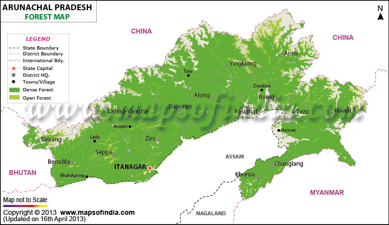
Arunachal Pradesh Forest Map
*Map Showing Forest areas in Arunachal Pradesh.
Disclaimer:
All efforts have been made to make this image accurate. However Mapping Digiworld Pvt Ltd and its directors do not own any responsibility for the correctness or authenticity of the same.
Hotels in Arunachal Pradesh
Itanagar Hotels
Related Links
Arunachal Pradesh Profile
West Bengal Tourism
Travel Maps of India
Information on Arunachal
Pradesh
Last Updated on:
Mar 30, 2019