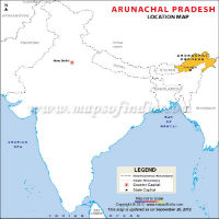
Arunachal Pradesh is a state located in the northeastern part of India. Known for its pristine beauty and lush green forests, the state is also known as the 'Land of the Rising Sun'. A sparsely populated state of India, Arunachal Pradesh is bordered on the south by Assam, on the west by Bhutan, on the north and northeast by China, and on the east by Myanmar (formerly known as Burma). It covers and area of 83,743 sq km.
Most of Arunachal Pradesh is mountainous. Its terrain consists of lofty, haphazardly aligned ridges that separate deep valleys and rise to the peaks of the Great Himalayas.
The main rivers of Arunachal Pradesh are the Brahmaputra, which is also known as the Siang, and its tributaries, the Tirap, the Lohit (Zayu Qu), the Subansiri, and the Bhareli. The climate of the foothills is subtropical; in the mountains, temperatures decrease rapidly with altitude. Rainfall averages between 2000 and 4000 mm (80 and 160 in) a year.
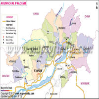
Arunachal Pradesh has a single-chamber Legislative Assembly, which has 60 seats. The state sends three members to the Parliament. It sends one to the Rajya Sabha (upper house) and two to the Lok Sabha (lower house). The state is divided into 20 districts.
| Facts on Arunachal Pradesh | |
|---|---|
| Official Website | www.arunachalpradesh.gov.in |
| Date of Formation | 20/02/87 |
| Area | 83,743 km sq |
| Density | 17/Km2 |
| Population (2011) | 1383727 |
| Males Population (2011) | 713912 |
| Females Population (2011) | 669815 |
| No. of District | 20 |
| Capital | Itanagar |
| Rivers | Siang and its Tribhutaries: Lohit, Kameg, Dikrong, Tirap, Dibang, Subansiri, Dihing, Kamlang are flow through Bharamaputra River. |
| Forests & National Park | Namdapha NP, Mouling NP |
| Languages | Monpa, Miji, Aka, Sherdukpen, Apatani, Adi, Hill Miri |
| Neighbours State | Asom (assam) and Nagaland |
| State Animal | Mithun |
| State Bird | Great Hornbill |
| State Tree | Hollong |
| State Flower | Retusa |
| Net State Domestic Product (2011) | 55789 |
| Literacy Rate (2011) | 66.95% |
| Females per 1000 males | 920 |
| Assembly constituency | 60 |
| Parliamentary constituency | 2 |
The region that is now Arunachal Pradesh is mentioned in the Puranas (Sanskrit writings about the beginning of the world), but little else is known of the state's early history. Part of Arunachal Pradesh was annexed by the Ahom kings of Assam in the 16th century.
In 1826, Assam became a part of British India, but efforts to bring Arunachal Pradesh under British administration did not begin until the 1880s. In 1912, the region became an administrative unit within Assam, called the North Eastern Frontier Tract (NEFT); in 1954 the NEFT became the North East Frontier Agency. Its northern boundary with Tibet has been disputed since 1913, when China rejected British proposals that the border should follow the crest of the Himalayas.
This proposed border, known as the McMahon line, has ever since served as the de facto boundary. After the independence of India in 1947, China made claims to practically the whole area covered by the districts of East and West Kameng, Lower and Upper Subansiri, East and West Siang, and Lohit, arguing that the McMahon Line had never been accepted by China and was the result of British "aggression." More Detail...
Arunachal Pradesh shares its state borders with Nagaland and Assam and international border with Bhutan, China, and Myanmar. The northern part of the state is covered by the Himalaya Range. This mountain range actually separates Arunachal Pradesh and Tibet in the east. Apart from the Himalaya Range, the majority of the land is covered by the Patkai hills and the Himalayan foothills. More Detail...
The weather condition of the state changes with elevation. Upper Himalaya range of the state enjoys a Tundra climate while Middle Himalaya range has a temperate climate. The Sub-Himalaya areas and sea-level areas have sub-tropical and humid summers and mild winters.
Arunachal Pradesh government involves the functions of a unicameral legislative body. The legislative council is formed of 60 members of the legislative assembly. They are the very center of the government and politics of Arunachal Pradesh. The governor, V Shanmuganathan, is the legislative head of the state.
The executive of Arunachal Pradesh includes a council of ministers with 11 cabinet ministers. Various secretariat and directorate wings smoothly carry out the function of the various government departments. They are also involved in the planning and the execution of various government projects in Arunachal Pradesh. More Detail...
Agriculture drives the economy of the state. Pulses, rice, wheat, sugarcane, maize, millet, oilseeds, and ginger are the main crops grown here. Since forests cover a major part of Arunachal Pradesh, forest products are also an important base of the economy. There are a number of fruit preservation departments, rice mills, fruit orchards, handloom handicrafts, and horticulture units in Arunachal Pradesh. Arunachal Pradesh is well endowed with an abundant forest cover, mineral, and hydel power resources. Rice is the principal crop. Other important crops are maize, millet, wheat, pulses (edible seeds gathered from pea and bean crops), potatoes, sugarcane, fruit, and oilseeds.
Itanagar is the capital and seat of the state government. There are 20 districts in the state and each is governed by a district collector. Padmanabha Acharya is the Governor and Pema Khandu is the Chief Minister of the state.
Most of the population of Arunachal Pradesh is of Asiatic origin and shows physical affinity with the people of Tibet and Myanmar. There are dozens of tribes and sub tribes. In western Arunachal Pradesh the main tribes are the Nissi (Nishi or Dafla), Sulung, Sherdukpen, Aka, Monpa, Apa Tani, and Hill Miri. The Adi, the largest tribal group in the state, occupy the central region. The Mishmi occupy the northeastern hills, and the Wancho, Nocte, and Tangsa inhabit the southeastern district of Tirap. These tribal groups speak about 50 distinct languages and dialects, belonging mostly to the Tibeto-Burmese branch of the Sino-Tibetan language family. They are often mutually unintelligible and, thus, Assamese, Hindi, and English are used as lingua francas in the region. As a rule, the tribes do not intermarry, and each follows distinct social, cultural, and religious practices.
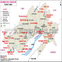
Often termed as a natural wonder, the state has a number of popular tourist destinations. Some of the famous places in Arunachal Pradesh are Itanagar, Tawang, Bomdila, Bhismaknagar, and Akashiganga. There are four National parks and seven wildlife sanctuaries in the state, which are prime tourist attractions. Itanagar is famous for its excavated ruins of the historical Ita Fort, and the attractive Gyaker Sinyi or the Ganga Lake. Malinithan and Bhismaknagar are the two important archaeological sites in the state, and Parashuram Kund is a prominent pilgrimage site. Namdapha Wildlife sanctuary in the Changlang district is home to the rare Hoolock gibbon.