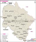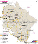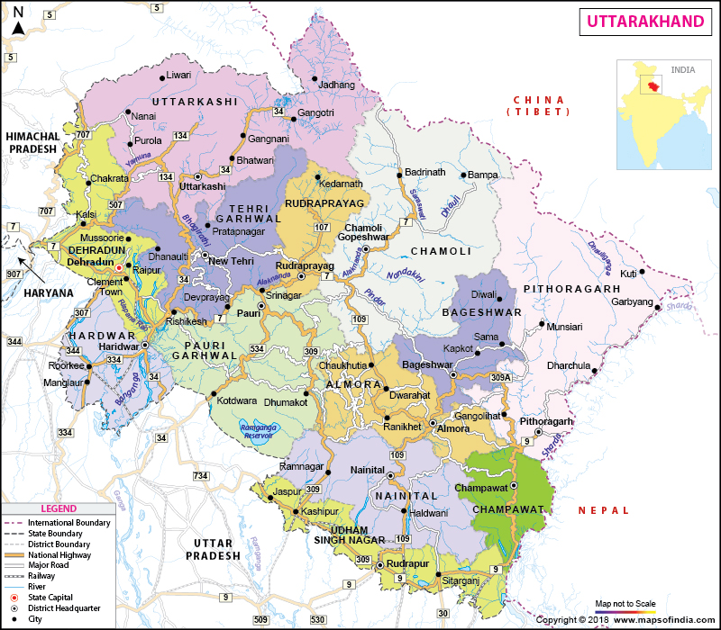
| *Map of Uttarakhand with districts, railways, rivers and major road network. |
| Disclaimer: All efforts have been made to make this image accurate. However Mapping Digiworld Pvt Ltd and its directors do not own any responsibility for the correctness or authenticity of the same. |
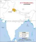
Uttarakhand is a state situated in northern India. Formerly known as Uttrakhand, this state was formed out of the north-western districts of Uttar Pradesh and the Himalayas on 9 November 2000. Also refereed to as the Land of Gods, Uttrakhand is believed to be one of the most naturally bestowed states in India. Uttrakhand shares its borders with Tibet in the north, Uttar Pradesh in the south, Nepal in the east, Haryana in the west and Himachal Pradesh in the North West.
Uttrakhand is home to some of the finest Hindu temples and religious destinations in India. In the year 2007 Uttaranchal was renamed Uttrakhand which means part of the North. The state stretches over an area of 20,682 sq mi of land. Dehradun serves as the capital of state.
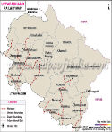
While traveling to Uttrakhand it is always advisable to carry a map of the state. There are many different maps of Uttrakhand in India that provide complete information about the important roads, hotels, tourists spots, hospitals etc in the state.
| Country | India |
|---|---|
| State | Uttrakhand |
| District | 13 districts |
| Area | 20,682 sq mi |
| Population (Census 2011) | 10,116,752 |
| Coordinates | 30°20'N 78°04'E? / ?30.33°N 78.06°E |
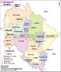
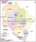
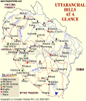
Uttrakhand has 13 districts which are grouped into two divisions namely Garhwal division and Kumaon division.
The Garhwal division includes seven districts.
The Kumaon division includes six districts.
Uttrakhand State Information |
|
|---|---|
| Capital | Dehradun |
| Date of formation | 9. Nov. 2000 |
| Governor | Krishna Kant Paul |
| Chief Minister | Trivendra Singh Rawat |
| Tourist attractions | Corbett NP, Nainital, Almora Valley of Flowers, Nanda Devi Park |
| Festivals | Devidhura Mela, Nanda Devi Mela, Purnagiri Mela Major dance and music forms Garhwali folk dance and music |
| Arts and crafts | Kholi woodcarving; Aipan or rangoli |
| Languages | Hindi, Garhwali, Kumaoni |
| Size | 53,483 sq. kin |
| Population | 10,086,292 |
| Rivers | Ganga, Yamuna, Ramganga, Kali |
| Forests and wildlife sanctuaries | Nanda Devi NP, Rajaji NP, Corbett Tiger Reserve. |
| State animal | Himalayan musk deer |
| State bird | Himalayan monal |
| State flower | Brahm kamal |
| State tree | Burans |
| Major crops | Rice, wheat, arley, jowar, oilseed |
| Factoids | Kedarnath temple, at a height of 3584 m, is devoted to Shiva. |
| The Kol-Munds, a Dravidian people, were probably the first to live here. | |
| No. of District | 13 |