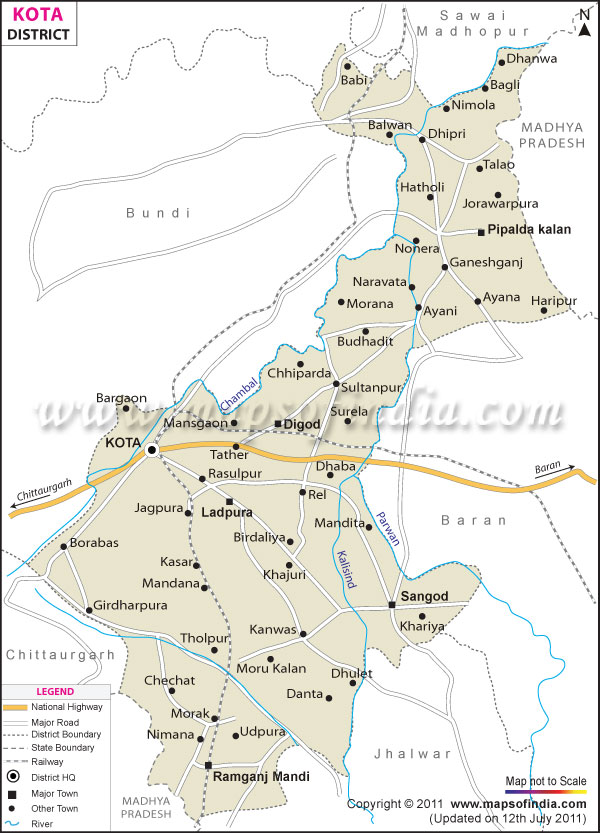
*The Map showing National Highway, Major Roads, District Head Quarter etc in the district of Kota Rajasthan.
Disclaimer: All efforts have been made to make this image accurate. However Mapping Digiworld Pvt Ltd and its directors do not own any responsibility for the correctness or authenticity of the same.
Kota is a beautiful town in Rajasthan, full of gaiety, cheer and steeped in colorful history. Located on the eastern bank of the Chambal River, Kota once belonged to the princely state of Bundi under the rule of the Chauhans.
Kota is well known for its ancient palaces, havelis or mansions and castles. In the 17th century, Emperor Jahangir declared Kota a separate state and it was ruled by Rao Madho Singh the heir apparent to the throne of Kota. The city is a modern settlement now and is known for its natural and man made marvels.
Though Kota boasts of a small airport, the main international airport at Jaipur (240 km) connects it to the rest of the world through regular flight services. Kota is a main railhead and connects the city with other major railway junctions in the country. Being situated on the NH 12 (Jaipur Jabalpur Highway) has provided Kota excellent road links with the rest of India.
Dussehra is one of the prime festivals of Rajasthan and is celebrated with great pomp and grandeur in Kota. The festival commemorates the 9 day battle between Rama, the Divine king and Ravana, a demon. On the 10th day is called the Vijaya Dashami or the 'Day Of Victory'. Ram Lila enactments of this epic battle and other devotional programs are organized all through this period.
The main attractions of the city of Kota are:
Kota Fort
Chambal Garden
Maharao Madho Singh Museum
The Government Museum
Jag Mandir- Kishore Sagar
Haveli Of Devtaji
Kota Barrage
Kansua Temple
Bhitria Kund
Adhar Shila Budh Singh Bafna Haveli
Yatayat Park
<div class='table-responsive'><table class="tableizer-table"> <tr class="tableizer-firstrow" align="center"><th colspan="2">Facts of Kota District</th></tr> <tr><td>State</td><td>Rajasthan</td></tr> <tr><td>District</td><td>Kota</td></tr> <tr><td>District HQ</td><td>Kota</td></tr> <tr><td>Population (2011)</td><td>1,951,014</td></tr> <tr><td>Growth</td><td>24.39%</td></tr> <tr><td>Sex Ratio</td><td>911</td></tr> <tr><td>Literacy</td><td>76.56</td></tr> <tr><td>Area (km<sup>2</sup>)</td><td>5446</td></tr> <tr><td>Density (/km<sup>2</sup>) </td><td>374</td></tr> <tr><td>Tehsils </td><td>Digod, Ladpura, Pipalda, Ramganj Mandi, Sangod</td></tr> <tr><td>Lok Sabha Constituencies </td><td>Kota</td></tr> <tr><td>Assembly Constituencies </td><td>Kota North, Kota South, Ladpura, Pipalda, Ramganj Mandi, Sangod</td></tr> <tr><td>Languages </td><td>Hindi, Rajasthani including Hadoti</td></tr> <tr><td>Rivers </td><td>Chambal</td></tr> <tr><td>Lat-Long </td><td>25.213639,75.864615</td></tr> <tr><td>Travel Destinations </td><td>Chambal Garden, Maharao Madho Singh Museum, The Government Museum, Jag Mandir, Haveli of Devtaji, Kota Barrage, Kansua temple, Bhitria Kund, Adhar Shila, Budh Singh Bafna haveli, Yatayat Park, Haryali Water Park, Godavari Dham Mandir etc.</td></tr> <tr><td>Government Colleges/Universities </td><td>University of Kota, Government College (Gangapur City), Government Girls College (S.Madhopur), Government P.G. College (S.Madhopur), Govt. College (Bamanwas) etc.</td></tr> </table></div>