
| *India Map Showing the Location of the State Rajasthan |
| Disclaimer: All efforts have been made to make this image accurate. However Mapping Digiworld Pvt Ltd and its directors do not own any responsibility for the correctness or authenticity of the same. |
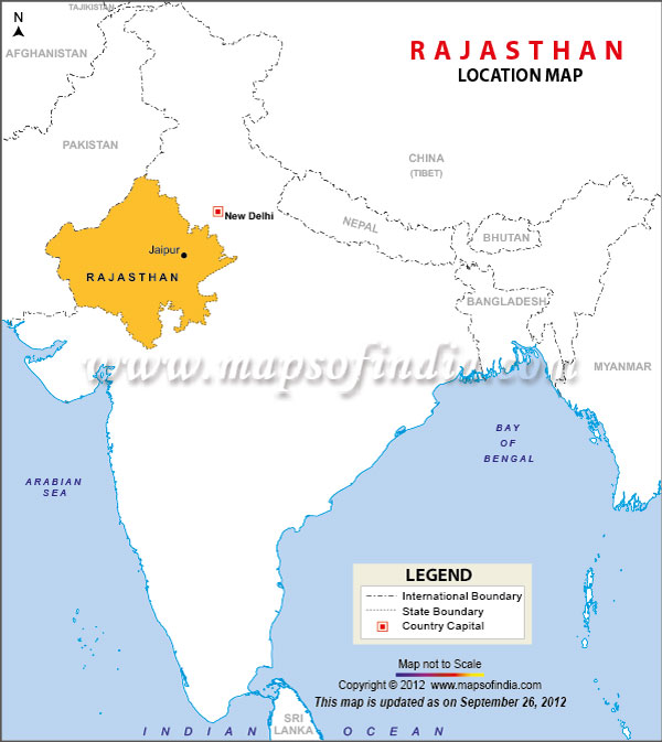
Situated in the northwestern region of India, colorful Rajasthan has the neighboring country of Pakistan as its northwestern boundary, Uttar Pradesh, Punjab and Haryana as its northeastern and northern frontiers, Madhya Pradesh and Uttar Pradesh manning its east and southeastern fronts and its southwestern borders being manned by Gujarat.
The latitude of Tropic of Cancer, cuts across Banswara in the south.
It is spread over 132,140 square miles that amounts to 342,239 in the unit square kilometers.
Rajasthan is positioned between 23 degrees and 30' and 30 degrees and 11' on the northern latitude and 69 degrees and 29' and 78 degrees and 17' on the east longitude.
Vibrant Jaipur, popularly known as the Pink City, is the capital city of vivacious Rajasthan.
| Geography | History | Weather |
| Area | Languages | Population |
| Desert | Quick Facts | Soil and Vegetation |
| Art | Dress | Fairs and Festivals |
| Food | Culture | Rajasthan Factsheet |