Bihar is a state in India that is situated to the eastern side of the country. The district is the 12th largest in terms of land and ranks third in terms of population.
To begin
Each district is headed by deputy commissioner of Indian Administrative service or the
Bihar is surrounded by Nepal to the north, the state of Uttar Pradesh to the west, West Bengal to the east and Jharkhand to the south. Bihar state lies approximately between 21
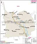
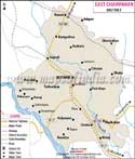
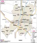
Every district is distinct and is significant in its own way. Araria is famous for the jute mills and cultivation of crops like Paddy and maize. The Aurangabad district is known for the woolen carpets and blankets. Gaya is important for its heritage site Bodhgaya, which is an important pilgrimage site of Buddhism. Buxar and Dharbanga are very important districts of the state and they produce crops like rice, sugarcane
Patna, Muzaffarpur, Gaya and many other districts are well connected by a network of
| Sr. No. | District | District HQ | Population (2011) | Growth | Sex Ratio | Literacy | Area (km2) | Density (/km2) |
|---|---|---|---|---|---|---|---|---|
| 1 | Araria | Araria | 2811569 | 30.25% | 921 | 53.53 | 2829 | 992 |
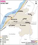
| 2 | Arwal | Arwal | 700843 | 18.89% | 928 | 67.43 | 4839 | 1099 |
| 3 | Aurangabad | Aurangabad | 2540073 | 26.18% | 926 | 70.32 | 3303 | 760 |
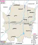
| 4 | Banka | Banka | 2034763 | 26.48% | 907 | 58.17 | 3018 | 672 |
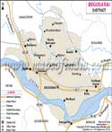
| 5 | Begusarai | Begusarai | 2970541 | 26.44% | 895 | 63.87 | 1917 | 1540 |
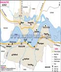
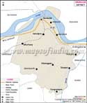
| 6 | Bhagalpur | Bhagalpur | 3037766 | 25.36% | 880 | 63.14 | 2569 | 1180 |
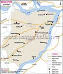
| 7 | Bhojpur | Arrah | 2728407 | 21.63% | 907 | 70.47 | 2473 | 1136 |
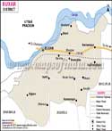
| 8 | Buxar | Buxar | 1706352 | 21.67% | 922 | 70.14 | 1624 | 1003 |
| 9 | Darbhanga | Darbhanga | 3937385 | 19.47% | 911 | 56.56 | 2278 | 1721 |
| 10 | Gaya | Gaya | 4391418 | 26.43% | 937 | 63.67 | 4978 | 880 |
| 11 | Gopalganj | Gopalganj | 2562012 | 19.02% | 1021 | 65.47 | 2033 | 1258 |
| 12 | Jamui | Jamui | 1760405 | 25.85% | 922 | 59.79 | 3099 | 567 |
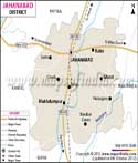
| 13 | Jehanabad | Jehanabad | 1125313 | 21.68% | 922 | 66.8 | 1569 | 1206 |
| 14 | Kaimur | Bhabua | 1626384 | 26.17% | 920 | 69.34 | 3363 | 488 |
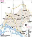
| 15 | Katihar | Katihar | 3071029 | 28.35% | 919 | 52.24 | 3056 | 1004 |
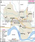
| 16 | Khagaria | Khagaria | 1666886 | 30.19% | 886 | 57.92 | 1486 | 1115 |
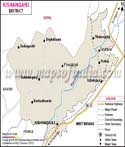
| 17 | Kishanganj | Kishanganj | 1690400 | 30.40% | 950 | 55.46 | 1884 | 898 |
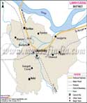
| 18 | Lakhisarai | Lakhisarai | 1000912 | 24.77% | 902 | 62.42 | 1229 | 815 |
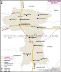
| 19 | Madhepura | Madhepura | 2001762 | 31.12% | 911 | 52.25 | 1787 | 1116 |
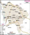
| 20 | Madhubani | Madhubani | 4487379 | 25.51% | 926 | 58.62 | 3501 | 1279 |
| 21 | Munger | Munger | 1367765 | 20.21% | 876 | 70.46 | 1419 | 958 |
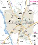
| 22 | Muzaffarpur | Muzaffarpur | 4801062 | 28.14% | 900 | 63.43 | 3173 | 1506 |
| 23 | Nalanda | Bihar Sharif | 2877653 | 21.39% | 922 | 64.43 | 2354 | 1220 |
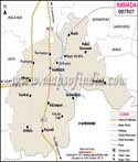
| 24 | Nawada | Nawada | 2219146 | 22.63% | 939 | 59.76 | 2492 | 889 |
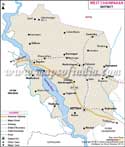
| 25 | Pashchim Champaran | Bettiah | 3935042 | 29.29% | 909 | 55.7 | 5229 | 753 |
| 26 | Patna | Patna | 5838465 | 23.73% | 897 | 70.68 | 3202 | 1803 |
| 27 | Purbi Champaran | Motihari | 5099371 | 29.43% | 902 | 55.79 | 3969 | 1281 |
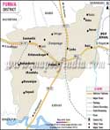
| 28 | Purnia | Purnia | 3264619 | 28.33% | 921 | 51.08 | 3228 | 1014 |
| 29 | Rohtas | Sasaram | 2959918 | 20.78% | 918 | 73.37 | 3850 | 763 |
| 30 | Saharsa | Saharsa | 1900661 | 26.02% | 906 | 53.2 | 1702 | 1125 |
| 31 | Samastipur | Samastipur | 4261566 | 25.53% | 911 | 61.86 | 2905 | 1465 |
| 32 | Saran | Chhapra | 3951862 | 21.64% | 954 | 65.96 | 2641 | 1493 |
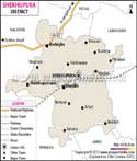
| 33 | Sheikhpura | Sheikhpura | 636342 | 21.09% | 930 | 63.86 | 689 | 922 |
| 34 | Sheohar | Sheohar | 656246 | 27.19% | 893 | 53.78 | 443 | 1882 |
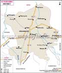
| 35 | Sitamarhi | Sitamarhi | 3423574 | 27.62% | 899 | 52.05 | 2199 | 1491 |
| 36 | Siwan | Siwan | 3330464 | 22.70% | 988 | 69.45 | 2219 | 1495 |
| 37 | Supaul | Supaul | 2229076 | 28.66% | 929 | 57.67 | 2410 | 919 |
| 38 | Vaishali | Hajipur | 3495021 | 28.57% | 895 | 66.6 | 2036 | 1717 |