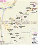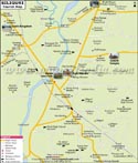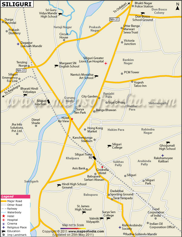
| *Map showing major roads, landmarks, places of interest, etc of Siliguri city. |
| Disclaimer: All efforts have been made to make this image accurate. However Mapping Digiworld Pvt Ltd and its directors do not own any responsibility for the correctness or authenticity of the same. |
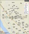
Siliguri is located in the Darjeeling district of West Bengal between latitude 26° 42' N and Longitude 88°25'E. The city, spread over 48.3 square kilometers, is located on the banks of the Mahananda River, in the foothill of the Himalayan Mountains, in the northern part of the state.
The river runs through the center of the city and divides it into two halves. Siliguri has hot summers with average temperature of 35°C and cool winters with temperature of 10°C. In winter the temperature can also touch 2°C. The city gets heavy rain during the monsoon months and sometimes access to the upper regions of the state is cut off.
As the city is located in the narrow Siliguiri Corridor or the strip of land connecting India to north east states, it is one of the most important transport hubs of the north east region. The national highway number 31 passes on the west of the city and connects it to Jhumritaliaya, Koderma, Bihar Sharif, Dhakhola in Bihar and West Bengal, and then further to Kokrajhar, Nalbari, to end at Guwahati. This is the most important highway in the region as it connects the north east states and as it passes through Siliguiri, the city has come to be called the Gateway to the North East.
Siliguri falls in the North eastern Frontier Zone of the Indian Railways and has a meter gauge connection as well as a narrow gauge rail track. The narrow gauge rail track is for the heritage Darjeeling Himalayan Railway connecting the city to Darjeeling. The rail line passes through the city and has two important railway stations. One is at Siliguri Junction and the other is at Siliguri town. The meter gauge rail track connects Siliguri to Gauhati and Dibrugarh in Assam, besides Delhi. The city has the only airport in the region at Bagdogra, 15 kilometers away from the city.
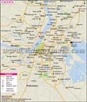
Siliguri has now become an important educational and business center in the region and is the second largest city in West Bengal. The population of the city is mainly Bengali, though immigration from the neighboring state of Bihar and from the north eastern country of Nepal and Bangladesh has added to the population of the city. The residential areas are Gurung Basti, Babupara, Rabindra Nagar, Hakim Para, Haldar Para, Don Bosco Colony, Prakash Nagar and Subhaspally. Some of the business offices located in the city are that of the Food Corporation of India, Indian Oil Corporation, Axis Bank, Durga Hyundai, and Prakash Distillery.
Siliguri has one of the highest literacy rates in the state and has a number of educational institutions. The city caters to not only people of the state but also from the neighboring states of Sikkim, Bihar and Assam. The medium of instruction is varied - Bengali, English, along with Nepali and Hindi.
Some of the educational institutes are
The important landmarks of the city include