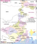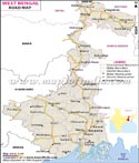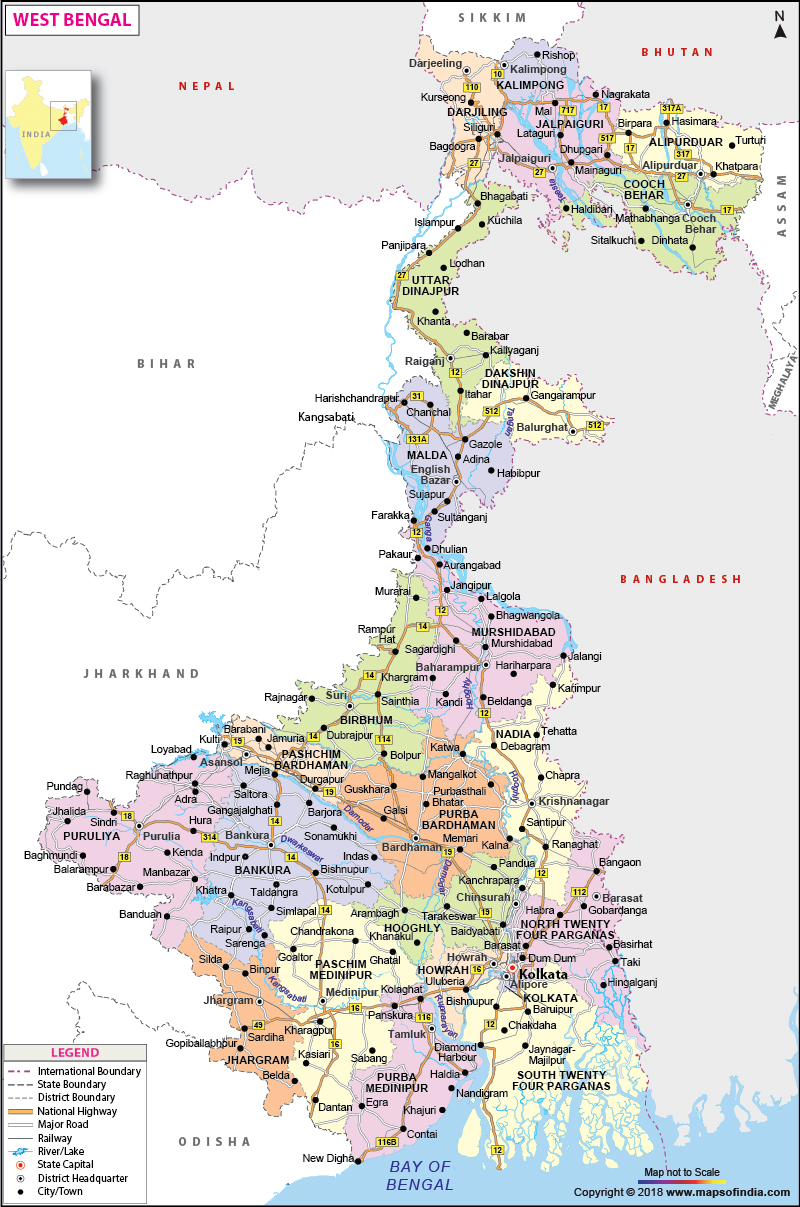
| *Map of West Bengal with districts, railways, rivers and major road network. |
| Disclaimer: All efforts have been made to make this image accurate. However Mapping Digiworld Pvt Ltd and its directors do not own any responsibility for the correctness or authenticity of the same. |
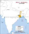
West Bengal is a state which is located in eastern India. The state extends from Bay of Bengal in the south to the Himalayan mountain ranges in the north. The capital of the state of West Bengal is Kolkata and it is the biggest city of the state as well. In Bengali language, it is referred to as Paschim Banga.
In terms of population, West Bengal ranks as the fourth most populated state in India.
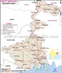
There are 23 districts in the state and they are as follows:
Darjeeling, Cooch Behar, Malda, Jalpaiguri, South Dinajpur (Dakshin Dinajpur), North Dinajpur (Uttar Dinajpur), Bardhaman, Bankura, East Midnapore (Purba Medinipur), Birbhum, Purulia, Hooghly, Howrah, West Midnapore (Paschim Medinipur), Murshidabad, Kolkata, North 24 Parganas (Uttar 24 Parganas), Nadia, and South 24 Parganas (Dakshin 24 Parganas).
Divisions of West Bengal
There are three divisions in the state and they are the Jalpaiguri division, Burdwan division, and Presidency division.
Area of West Bengal
The state covers a total area of 34,267.3 sq miles or 88,752 km2.
Population of West Bengal
According to the census performed in 2011, the population of the state is 91,347,736.
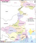
Tourist Attractions in West Bengal
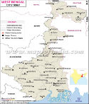
The state is known all over the globe for the Sunderbans. It has nineteen districts and the major cities are Kolkata, Siliguri, Burdwan, Durgapur, Kharagpur, Darjeeling and Malda.
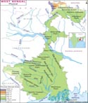
The state is home to two very big natural zones and they are the sub-Himalayan and Himalayan region to the north and the Gangetic Plain to the south.
Neighboring states and countries
The neighboring states are Jharkhand , Odisha , Sikkim , bihar , and Assam. The state shares its international boundaries with Bhutan, Nepal, and Bangladesh.
Economy
The principal occupation of the people of the state is farming. It makes the sixth highest contribution to the Gross Domestic Product of the country.
The state is a pioneer in bringing modern education in India. Given below are the names of the famous educational institutes in the state:
Bengal Engineering and Science University, Shibpur, Aliah University, Jadavpur University, Bidhan Chandra Krishi Viswavidyalaya Haringhata, Presidency University, Kolkata, Netaji Subhas Open University, Ramakrishna Mission Vivekananda University, Rabindra Bharati University, University of Burdwan, University of Calcutta, Sidho Kanho Birsha University, University of Kalyani, University of North Bengal, University of Gour Banga, Vidyasagar University, Uttar Banga Krishi Vishwavidyalaya, West Bengal State University, Visva-Bharati University, West Bengal University of Health Sciences, West Bengal University of Animal and Fishery Sciences, West Bengal National University of Juridical Sciences and West Bengal University of Technology.
At present, the Governor of the state is Mr. Keshari Nath Tripathi. He is appointed by the President of India for a term of five years and acts as the constitutional head of the state. The Chief Minister of West Bengal is Smt. Mamata Banerjee who represents the Trinamool Congress party. The Legislative Assembly or Vidhan Sabha of the state is unicameral in nature and contains 295 seats.
The state has diverse geographical features which include towering summits of the Himalayan Mountain Range, flat terrain, rivers, and sea. The state shares its boundaries with the Himalayas in the north and the Bay of Bengal to the south. To the west, it is bordered by the states of Jharkhand and Bihar. To the east, it is edged by Bangladesh. To the northeast, it is bordered by Assam, Sikkim and Bhutan. The territory of Nepal lies to the northwest. The state of Orissa is situated to the southwest of the state.
The state is made up of the following varieties of landforms:
The state can be divided into the following agro-climatic regions:
West Bengal State Information |
|
|---|---|
| Capital | Kolkata |
| Date of formation | 26/01/50 |
| Governor | Keshari Nath Tripathi |
| Chief Minister | Mamata Banerjee |
| Tourist attractions | Victoria Memorial, Vidyasagar Setu, Shantiniketan, Darjeeling |
| Festivals | Durga Puja, Rabindra Jayanti |
| Major dance and music forms | Jatra theatre; Baul; Rabindrasangeet |
| Arts and crafts | Terracotta Bankura horses; Kalighat style of painting; hand-woven Baluchari Silk textiles |
| Languages | Bengali, Hindi, Urdu |
| Size | 88,752 sq. km |
| Population (Census 2011) | 91276115 |
| Rivers | Hooghly, Teesta, Torsa, Subarnarekha, Joldhara |
| Forests and wildlife sanctuaries | Sunderbans Tiger Reserve, Jaldapara WS |
| State animal | Fishing cat |
| State bird | White-throated kingfisher |
| State flower | Shephali |
| State tree | Devil tree or chatian |
| Major crops | Rice, maize, oil seeds, sugarcane |
| Factoids | Bengali literature developed early thanks to the cultural awakening brought about by the Brahmo Samaj. |
| Rabindranath Tagore, the first Asian to win the Nobel Prize for Literature, was from Bengal. | |
| No. of District | 23 |
| Varanasi To Darjeeling | Delhi To Darjeeling | Patna To Darjeeling |
| Kolkata to Siliguri | Varanasi to Siliguri | Patna to Siliguri |
| Delhi to Siliguri |
| Travel to Darjeeling | Travel to Kalimpong | Travel to Kolkata |
| Travel to Nakhoda Masjid | Travel to Siliguri |
| Places to visit in Darjeeling | Places to visit in kalimpong | Places to visit in Kolkata |
| Places to visit in Sliguri |