
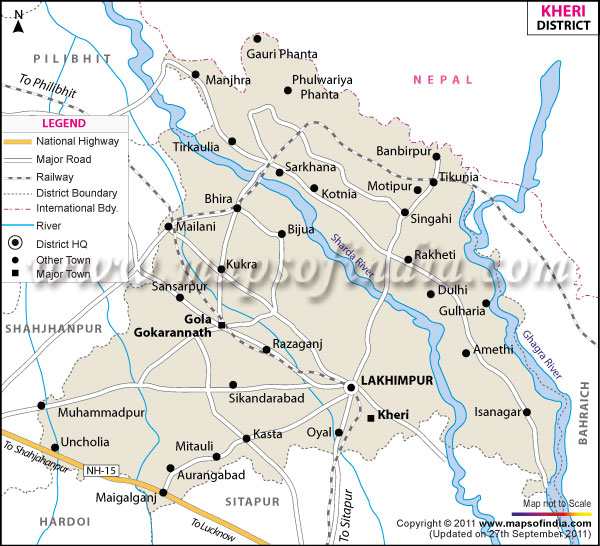
| *The Map showing the National Highway, Major roads, other Roads, District Headquarter, Town, etc in the Kheri District, Uttar Pradesh |
| Disclaimer: All efforts have been made to make this image accurate. However Mapping Digiworld Pvt Ltd and its directors do not own any responsibility for the correctness or authenticity of the same. |
Kheri is situated in the state of Uttar Pradesh, India. It is also known as Lakhimpur Kheri. The total area that Kheri District covers is 7680sq.km.
It is bordered by Nepal in the north, Shahjahanpur and Pilibhit districts in the west, Hardoi district in south and by the Behraich district in east.
Population in the district of Kheri is 40,13,634 .
In and around Kheri there are some temples which are visited by hundreds of people everyday. These are the Shiv Temple Gola, Frog Temple Oel, Shiv Temple Lilauti Nath and Shiv Temple Devkali.
| Facts of Kheri District | |
|---|---|
| State | Uttar Pradesh |
| District | Kheri |
| District HQ | Padrauna |
| Population (2011) | 4021243 |
| Growth | 25.38% |
| Sex Ratio | 894 |
| Literacy | 60.56 |
| Area (km2) | 2909 |
| Density (/km2) | 1226 |
| Tehsils | Dhaurahara, Gola Gokaran Nath, Lakhimpur, Mohammdi, Nighasan, Palia |
| Lok Sabha Constituencies | Kheri, Dhaurahra |
| Assembly Constituencies | 8-Dhaurahra, Gola Gokrannath, Kasta, Lakhimpur, Mohammdi, Nighasan, Palia, Sri Nagar |
| Languages | Hindi including Awadhi |
| Rivers | Sarda, Ghaghara |
| Lat-Long | 28.168875,80.633354 |
| Travel Destinations | Naseeruddin Memorial Hall, Eidgah, Shiv Temple Gola Gokarannath, Frog Temple, Sai Temple, Shiv Temple (Devakali) etc. |
| Government Colleges/Universities | St. Don Bosco'S College, Manu Law College, Guru Nanak Degree College, Royal Prudence Degree College etc. |