
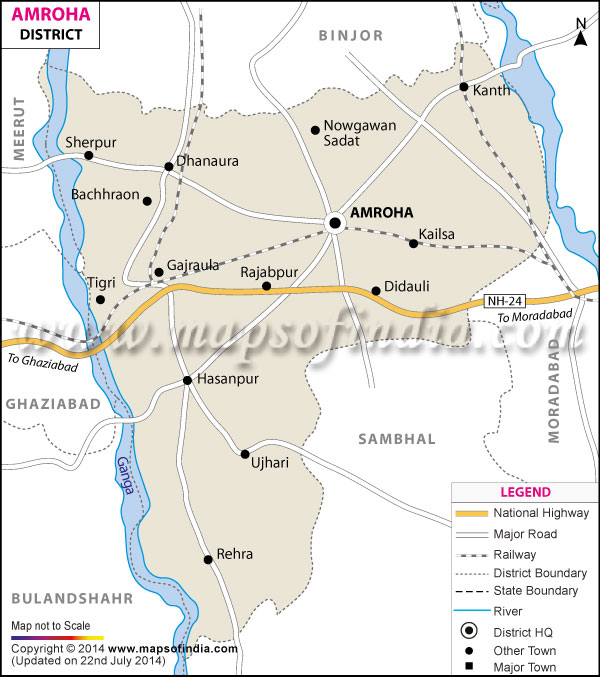
| *The Map showing the National Highway, Major roads, other Roads, District Headquarter, Town, etc in the Amroha District, Uttar Pradesh |
| Disclaimer: All efforts have been made to make this image accurate. However Mapping Digiworld Pvt Ltd and its directors do not own any responsibility for the correctness or authenticity of the same. |
Named after the eminent social worker and reformer Jyotiba Phule, the district of Jyotiba Phule Nagar falls under the state of Uttar Pradesh.
The geographical area that the district covers is 2470 Sq. Km. The global location of Jyotiba Phule Nagar lies between 28° 54' and 39° 6' north latitudes and between 78° 28' and 78° 39' east longitudes.
Agriculture is the pre-dominant occupation in the district. Besides crop-growing, cottage industry is also an important source of revenue in Jyotiba Phule Nagar.
Some of the tourist destinations which are situated in the district or nearby it are Vasudev Mandir and Tulsi Park, Nasiruddin Sahib ki Majaar, Gajraula and Tigri.
| Facts of Jyotiba Phule Nagar District | |
|---|---|
| State | Uttar Pradesh |
| District | Jyotiba Phule Nagar |
| District HQ | Amroha |
| Population (2011) | 1840221 |
| Growth | 22.76% |
| Sex Ratio | 910 |
| Literacy | 63.84 |
| Area (km2) | 2321 |
| Density (/km2) | 818 |
| Tehsils | Amroha, Dhanaura, Hasanpur |
| Lok Sabha Constituencies | Amroha |
| Assembly Constituencies | Amroha, Dhanaura, Hasanpur, Naugawan Sadat |
| Languages | Hindi, Urdu |
| Rivers | Ganga |
| Lat-Long | 28.774882,78.337612 |
| Travel Destinations | Syed Husain Sharaf-Ud-Din Shahvilayat etc. |
| Government Colleges/Universities | Govt. Rama Bai Ambedkar Degree College, Jagdish Saran Hindu College, B.I.Qureshi Degree College, Bhagirthi Degree College, Hashmi Girls Degree College, H.D. Degree College, M.Hussain Degree College, Nayab Abbasi Girls Degree College, Y.M.S. Degree College, H.M.U Hashmi College Of Law, Dns College Of Engineering And Technology, Maharaja Agrasen College Of Engineering And Technology etc. |