Ghazipur District Map

Buy Now  custom maps zoom map

Disclaimer: All efforts have been made to make this image accurate. However Mapping Digiworld Pvt Ltd and its directors do not own any responsibility for the correctness or authenticity of the same.

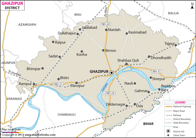
Ghazipur is a district in the state of Uttar Pradesh, India. It falls under the Varanasi Division of the state. The global location of Ghazipur is between 83° 4' and 83? 58' east longitude and 25° 19' and 25? 54' north latitude.

Ghazipur stretches over an area of 3384sq.km. The total population in Ghazipur is 36,22,727, according to the 2011 census.

Ghazipur is decorated by three rivers including Ganga, making it powerful economically. Among the many places of tourist interest, Aunrihar, Bahadurganj, Bhitari, Virpur, Gausour and Dildarnagar are the most talked-about places in Ghazipur.
Facts of Ghazipur District
State Uttar Pradesh
District Ghazipur
District HQ Ghazipur
Population (2011) 3620268
Growth 19.18%
Sex Ratio 952
Literacy 71.78
Area (km2) 3377
Density (/km2) 1072
Tehsils Ghazipur, Jakhania, Mohammadabad, Saidpur, Zamania
Lok Sabha Constituencies Ghazipur
Assembly Constituencies Ghazipur, Jakhanian, Jangipur, Mohammadabad, Saidpur, Zahoorabad, Zamania
Languages Hindi including Bhojpuri
Rivers Ganga
Lat-Long 25.621716,83.522758
Travel Destinations Cornwallis Mounment, Aunrihar, Bahadurganj, Bhitari, Dildarnagar, Zamania etc.
Government Colleges/Universities Post Graduate College, Ravindrapuri, Swami Sahajanand P G College, Khardeeha Degree College, Shahid Smarak Govt. Degree College, Skbm Degree College, Shree Prabhu Narayan Singh Degree College, Rajkiya Degree College, Rajkiya Mahila Degree College, Samata Degree College, Hindu Degree College etc.
Uttar Pradesh Districts