
| Disclaimer: All efforts have been made to make this image accurate. However Mapping Digiworld Pvt Ltd and its directors do not own any responsibility for the correctness or authenticity of the same. |
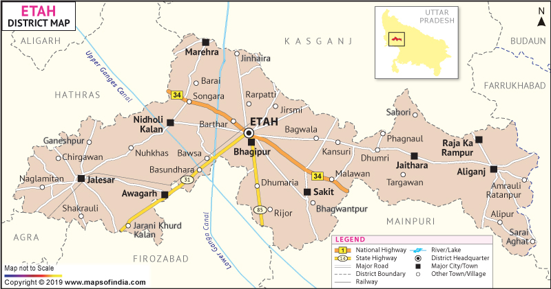
Etah is a district located almost at the center of Uttar Pradesh. The district lies between 78 ° 11' and 79 ° 17' East longitudes and 27 ° 18' and 28 ° 2' North latitudes.
The district covers an area of 4,446 sq. km. Population in Etah is 22, 44,998 as registered in the 1991 census.
Agriculture is the main stay in the district and various kinds of crops are grown in large amount.
| Facts of Etah District | |
|---|---|
| State | Uttar Pradesh |
| District | Etah |
| District HQ | Etah |
| Population (2011) | 1774480 |
| Growth | 13.62% |
| Sex Ratio | 873 |
| Literacy | 70.81 |
| Area (km2) | 2456 |
| Density (/km2) | 717 |
| Tehsils | Aliganj, Etah, Jalesar |
| Lok Sabha Constituencies | Etah |
| Assembly Constituencies | Aliganj, Etah, Jalesar, Marhara |
| Languages | Hindi, Urdu |
| Rivers | --- |
| Lat-Long | 27.5375,78.793144 |
| Travel Destinations | Sufi Sant Hazrat Abdul Gafoor Shah'S Dargaah, Bada Jain Mandir, Kailash Mandir, Kaali Mandir, Janta Durga Mandir, Pathwari Mandir etc. |
| Government Colleges/Universities | Scs Inter College, S.B.S Inter Colleage, Dr. Ram Kumar Gayatri Devi P.G. Collage, Sbs Degree College, Chet Ram Singh Inter Collge , Scs Inter College, Girls Govenment Inter College, Dr. Ramsingh And Rajbeti Inter College etc. |