About Meghalaya
History
Society
Information
Media in Meghalaya
Government
Geography
Pincode
STD Code
Governors
Chief Minister
Districts of Meghalaya
West Khasi Hills
East Garo Hills
West Garo Hills
South Garo Hills
More..
Meghalaya Map
Location Map
Physical Map
Forest Map
Agricultural Map
Mineral Map
Roads
Rivers
Tehsils
Railways
Cities in Meghalaya
Shillong City Map
Cherrapunji City Map
Travel to Meghalaya
Places to visit in Meghalaya
Wildlife Sanctuaries
Elephant Falls
Cherrapunji Travel
Education
Meghalaya 12th Date Sheet 2016
Meghalaya 10th Date Sheet 2016
Maps
Political Map
Physical Map
Outline Map
Railway Map
Road Map
More...
States of India
Uttar Pradesh
Maharashtra
Rajasthan
Karnataka
Tamilnadu
More...
Cities of India
Delhi
Mumbai
Kolkata
Chennai
Bangalore
More...
India Travel
Hotels in India
Tourist Places in India
Hill Stations
Beaches in India
Religious Places in India
More...
Utilities
Pin Codes
STD Search
Railway Time Table
Flight Schedule
Distance Calculator
More...
Education
Exam Date Sheet
Election
Assembly Polls in India
Parliamentary Constituencies
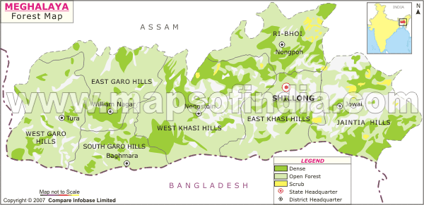
Meghalaya Forest Map
*Map showing showing areas under forest cover.
Disclaimer:
All efforts have been made to make this image accurate. However Mapping Digiworld Pvt Ltd and its directors do not own any responsibility for the correctness or authenticity of the same.
Last Updated on:
Mar 27, 2017