
| *Imphal East District Map highlights the National Highways, Major Roads, District Headquarter, etc in Imphal East . |
| Disclaimer: All efforts have been made to make this image accurate. However Mapping Digiworld Pvt Ltd and its directors do not own any responsibility for the correctness or authenticity of the same. |
Imphal East district is a beautiful place. Ranked 9th among the districts of Manipur state, Imphal East district was declared a district on 18th of June, 1997. Out of all nine districts of Manipur state, Imphal East is ranked second after Imphal West, in terms of tourism. It is divided into four Revenue Sub-Divisions with four urban local bodies and 237 revenue villages.
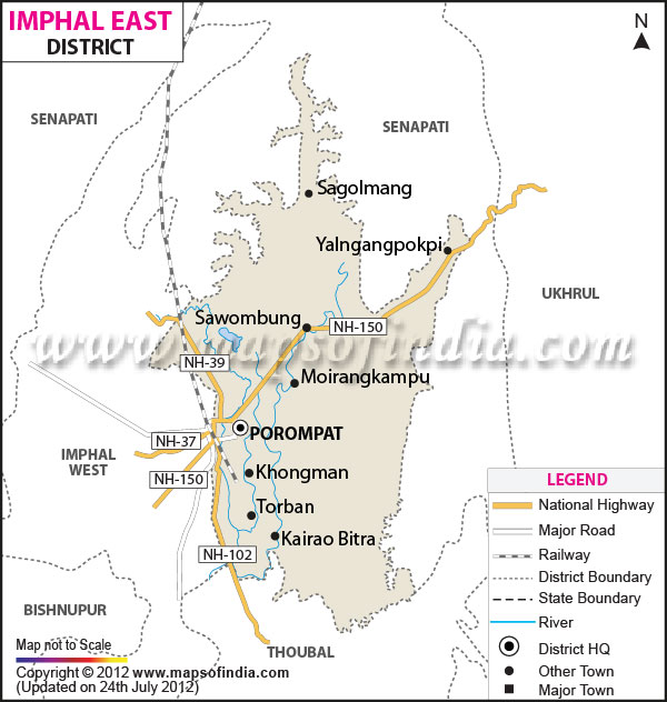
It is situated between two valleys: central valley and giriban valley. Nature has blessed the area with many rivers such as the Imphal, Iril, Sekmai, Thoubal, and Khuga which originate from the nearby hills surrounding the Imphal valley. These rivers not only enhance the beauty of the area, they also add to the agro productivity and fertility of the valley. Porompat is the administrative headquarter of the Imphal East district. For transportation, Imphal East is completely dependent on roads and highways, as the nearest railway station is around 200km from the town. The land area of Imphal East district is around 700 sq. kms and it's around 800 meters above the sea level.
Imphal East district is a favorite destination for both local and International tourists. There are numerous places with picturesque landscapes and scenic beauty, but the place worth mentioning is "Poirou Pat", which is surrounded by a small hillock.
Shree-Shree Govindajee Temple was a centre of cultural activities during the past maharajas and ancient kingdoms. War Cemetery reminds us of the sacrifices made by Indian and British soldiers who fought and died during the World War II. Women's Market or Ima Keithel is famous for colorful and beautiful cloths. Manipur Zoological Gardens is inhabited by the rare species of deer called the brow-antlered Thamin deer.
Matai Garden is situated on NH-39. The garden is famous for its myriad Duranta plant; it's a tropical shrub with beautiful and colorful petals.
Sambal-Lei-Sekpil garden is located in Sagolban, Kwakeithel, and Imphal. This is a famous place for a flower named Sambal-Lei-Sepals, which means fence flower topiary. It is the tallest shrub at 61ft. This topiary has a place in Guinness Book of Records to its credit.
The source of livelihood of the people of Imphal East district is mainly agriculture. The small scale industries of the district are bamboo work, cane work and carpentry.
The people of Imphal East district grow food crops like paddy, potato and other vegetables; but the crops like oil seed, sugar cane, pulse, maize, and other vegetables etc. are cash crops.
Imphal East district is connected via air, roadways and railways to many Indian cities. Daily flights are available from New Delhi to Imphal via Guwahati, Assam. Imphal is also linked to Kolkata, Bangalore and Aizawl via the airline route. The Imphal airport is located just 8 kms. from the city centre.
Dimapur railway station is the nearest railway station and it is around 215km from Imphal. Bus route is via NH39 where frequent bus and taxi services are available round the clock.
The temperature of the Imphal East district lies between 0.6degree Celsius (winter lowest) to 41 degree Celsius (summer maximum); the hottest months are May and June. Winters remain dry from November to February, whereas normal to heavy rainfall occurs during the rest eight months. Hotels are found in abundance here and you can choose one according to your budget.