Disclaimer: All efforts have been made to make this image accurate. However Mapping Digiworld Pvt Ltd and its directors do not own any responsibility for the correctness or authenticity of the same.
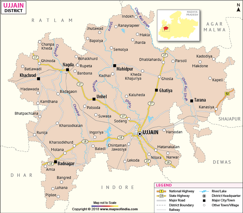
Having the holy and historical city of Ujjain as the headquarters, the Ujjain district is one of the important districts of Madhya Pradesh . m
Located in the western part of the state, Ujjain has a total area of 6100 square kilometers and a population of 13,83,000.
The district of Ujjain is visited every year by thousands of pilgrims and tourists. Some important destinations are Shree Mahakaleshwar Temple, Ved Shala-observatory and the Kalidasa Academy
Bade Ganeshji Ka Mandir, Chintaman Ganesh Temple, Pir Matsyendranath, Harsiddhi Temple, Siddhavat, Kal Bhairava Temple, Sandipani Ashram, Gadkalika Temple, Mangalnath Temple, Gopal Mandir, Navagraha Mandir, Mahakaleshwar Mandir, Chaubis Khamba, Nagarkot Ki Rani, Rama-Janardana Mandir, Rumi ka Makbara etc.
Government Colleges/Universities
Vikram University, Govt College (Badnagar), Govt Vikram College (Khachrod), Govt College (Nagda), Govt College (Tarana), Govt Kalidas Girls College, Govt Madhav Arts and Commerce & Law College, Govt Madhav Music PG College, Govt College (Ghattia), Govt College (Mahindpur), Govt Girls College, Govt Girls PG College, Shree Manmal Meemraj Ruiya Govt Sanskrit College, Govt Madhav Science College etc.