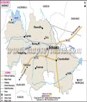
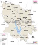
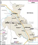
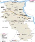
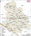
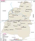
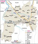
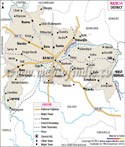
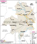
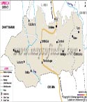
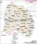
Jharkhand is the 28th state of the India Union located in East India. Earlier the state was a part of Bihar; but by the Bihar Reorganization Act, Jharkhand was given statehood on 15th November 2000. Some of the major districts of Jharkhand are Jamshedpur, Lohardaga Hazaribagh, Bokaro, Dhanbad, Sindri, Deoghar, and Gumla. A glance at the district maps of Jharkhand can help one in knowing about the various districts and their location in the state. The name Jharkhand is derived from the Sanskrit word Jharikhanda, which was the ancient name of the dense forest of the region.
Jharkhand is surrounded by Orissa in the South, Uttar Pradesh and Chhattisgarh in the West, Bihar in the North and West Bengal in the East. The state largely consists of forest tracks of Chhotanagpur plateau and Santhal Pargana and has divergent cultural tradition and practices. One of the major firms in India Tata Steel has its corporate office in Jharkhand.
Population |
21843911 |
|
ST |
28% of total |
|
SC |
12% of total |
|
Per capita Income |
Rs. 4161 |
|
Density of Population |
274 persons / Sq. KM |
|
No. of Districts |
18 + 4 |
|
No. of Sub divisions |
33 |
|
No. of Blocks |
211 |
|
No. of Villages |
32620 |
|
No. of Villages Electrified |
14667 |
45 % of total |
No. of Villages connected by roads |
8484 |
|
National Highways |
1006 KMs |
|
State Highways |
4662 KMs |
|
Health centers |
506 |
|
Schools |
21386 |
|
Universities |
5 |
Incl 1 deemed University |
Total Geographical Area |
79.70 Lakh Hect |
|
Cultivable Land |
38.00 Lakh Hect |
|
Net Sown Area |
18.04 Lakh Hect |
25% of total area |
Net Irrigated Area |
01.57 Lakh Hect |
8% of net sown area |
Forest |
29% of total area |
Jharkhand is a land of rich, vibrant and diverse cultural practices. A number of languages are spoken in the state including Kurukh, Panchparagnia, Karmali, Santhali, Mundari, Khortha, Nagpuria, Sadri, Khariya and Ho etc. Since Jharkhand is a newly formed state, it has witnessed relocation of people from various parts of India including West Bengal and Bihar besides others. New culture has made inroads to the state and this conglomeration has added to the already existing rich culture here.
Sarhul is a spring festival of Jharkhand celebrated by the tribal population; the celebration is to appease the village gods and seek his protection and safety. The tribal priest distributes a flower called Sarhul, which is given as offerings to the God to every house in a village. Folk music, dance and song are an important part of lifestyle of the people of Jharkhand.
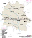
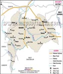
Jharkhand is the storehouse of a large number of minerals and resources. In terms of mineral resources Jharkhand is the richest State in India. Some of the important mineral resources available in the state are copper ore, bauxite, coal, iron ore, graphite, fine clay, china clay, limestone, dolomite, quartz sand etc. Some of the districts in particular are very rich in mineral resources, a quick glance at the district maps of Jharkhand plotting the availability of different mineral rescores can help the onlooker to know about the locations of the availability of minerals.
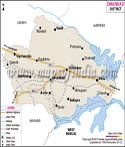
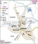
Endowed with exotic landscapes, stunning hills, breathtaking views and other natural elements, Jharkhand is an attractive destination for tourists. The tourism industry in Jharkhand has grown by leaps and bound recently with many tourists opting to visit the state to explore its natural beauty. Netarhat, Jagannath Mandir, Ranchi Hill,Hatia Dam, Betla National Park, Dasham Falls, Kanke Dam, Tagore Hill, Jonah Falls, Hoondru waterfalls and Baidyanath Dham are just a few of the tourist attraction that the state has to offer to travelers. A glance at the district maps of Jharkhand can help the tourist in getting an idea about the places they wish to visit on their trip.
| Sr. No. | District | District HQ | Population (2011) | Growth | Sex Ratio | Literacy | Area (km2) | Density (/km2) |
|---|---|---|---|---|---|---|---|---|
| 1 | Bokaro | Bokaro | 2062330 | 16.01% | 922 | 72.01 | 2861 | 716 |
| 2 | Chatra | Chatra | 1042886 | 31.77% | 953 | 60.18 | 3700 | 275 |
| 3 | Deoghar | Deoghar | 1492073 | 28.03% | 925 | 64.85 | 2479 | 602 |
| 4 | Dhanbad | Dhanbad | 2684487 | 11.99% | 909 | 74.52 | 2075 | 1284 |
| 5 | Dumka | Dumka | 1321442 | 19.42% | 977 | 61.02 | 4404 | 300 |
| 6 | East Singhbhum | Jamshedpur | 2293919 | 15.68% | 949 | 75.49 | 3533 | 648 |
| 7 | Garhwa | Garhwa | 1322784 | 27.75% | 935 | 60.33 | 4064 | 327 |
| 8 | Giridih | Giridih | 2445474 | 28.41% | 944 | 63.14 | 4887 | 497 |
| 9 | Godda | Godda | 1313551 | 25.35% | 938 | 56.4 | 2110 | 622 |
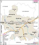
| 10 | Gumla | Gumla | 1025213 | 23.16% | 993 | 65.73 | 5327 | 193 |
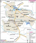
| 11 | Hazaribagh | Hazaribag | 1734495 | 20.65% | 947 | 69.75 | 4302 | 403 |
| 12 | Jamtara | Jamtara | 791042 | 21.12% | 954 | 64.59 | 1802 | 439 |
| 13 | Khunti | Khunti | 531885 | 22.32% | 997 | 63.86 | 2467 | 215 |
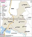
| 14 | Kodarma | Koderma | 716259 | 43.42% | 950 | 66.84 | 1312 | 427 |
| 15 | Latehar | Latehar | 726978 | 29.61% | 967 | 59.51 | 3630 | 200 |
| 16 | Lohardaga | Lohardaga | 461790 | 26.68% | 985 | 67.61 | 1494 | 310 |
| 17 | Pakur | Pakur | 900422 | 28.33% | 989 | 48.82 | 1805 | 498 |
| 18 | Palamu | Daltonganj | 1939869 | 26.17% | 928 | 63.63 | 5082 | 381 |
| 19 | Ramgarh | Ramgarh | 949443 | 13.10% | 921 | 73.17 | 1212 | 684 |
| 20 | Ranchi | Ranchi | 2914253 | 23.98% | 949 | 76.06 | 7974 | 557 |
| 21 | Sahibganj | Sahebganj | 1150567 | 24.01% | 952 | 52.04 | 1599 | 719 |
| 22 | Saraikela Kharsawan | Seraikela | 1065056 | 25.47% | 956 | 67.7 | 2725 | 390 |
| 23 | Simdega | Simdega | 599578 | 16.58% | 997 | 67.99 | 3750 | 160 |
| 24 | West Singhbhum | Chaibasa | 1502338 | 21.75% | 1005 | 58.63 | 7186 | 209 |