Disclaimer: All efforts have been made to make this image accurate. However Mapping Digiworld Pvt Ltd and its directors do not own any responsibility for the correctness or authenticity of the same.
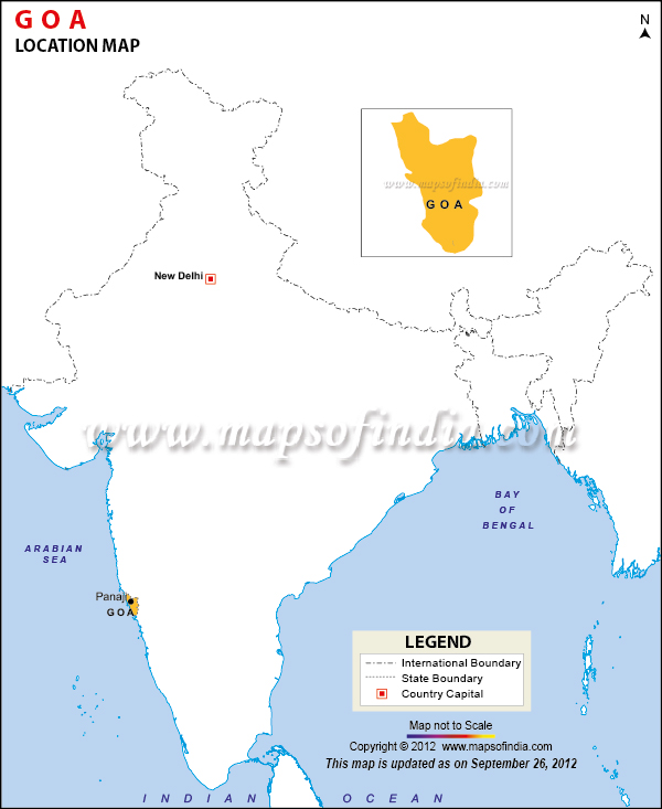
The location of Goa is on the western coast of the Indian peninsula, in the Konkan coastal belt.
It is separated from Maharashtra in the north, Karnataka in the south, the Western Ghats in the east, and the Arabian Sea in the west by the Terekhol River. It is the 25th State in the Union of States of India. Geographically, its position is between the latitudes 15°48'00" North to 14°53'54" North and longitudes 74° 20'13" East to 73° 40'33" East. The capital of Goa is Panjim or Panaji. Panjim is situated at a distance of 592 km from Bangalore and 593 km from Mumbai. Goa is split into two districts- North Goa and South Goa. North Goa includes the capital city of Panjim, the former capital of Old Goa, Fort Aguada and Candolim, Chapora, Vagator, and the beaches Calangute, Anjuna, and Baga. South Goa beaches include Vasco da Gama Bogmalo, Margao, Colva and Benolem
Goa is often referred to as the 'Pearl of the Orient' and is a 'tourist's paradise'. Legends have it that Lord Parshuram - an incarnation of the Lord Vishnu - created Goa. Over the ages it has been ruled by several successive kingdoms - the Rashtrakutas, Kadambas, Silaharas, Chalukyas, Bahamani Muslims etc. However, Goa's most famous rulers have been the Portuguese. On December 19, 1961, Goa was liberated from the Portuguese clutches by the Indian Army and made an Indian Union Territory. It attained Statehood in 1987.