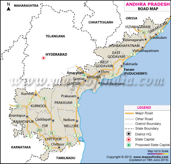
| Name of National Highway |
Passes through |
| National Highway 18 |
Kurnool - Nandyal - Cuddapah - Chittoor |
| National Highway 16 |
Mortad, Armoor, Koratla, Metpalli, Yelgonda, Jagtial, Mancherial, Lakshettipet, Adilabad district, Jaipur, and Chinnoor |
| National Highway 205 |
Puttur, Nagari, Tirupathi, Renigunta, Kalikiri, Pileru, Madanapalle Vayalpad, Burrakayalakotta, Kurabalakota, Patnam, Kadiri, Battulapalle, Mudigubba, and Anantpur. |
| National Highway 202 |
Amberpet, Golnaka, Uppal Kalan, Ramanthapur, Bhongir, Ghatkesar, Jangaon, Aleru, Station Ghanpur, Raghunathpalle, Atmakur, Warangal, Mulug, Mallampalli, Chandrupatla, Eturu Nagaram, and Bhadrakali. |
| National Highway 214 |
Amalapuram, Kakinada, Narasapur, Razole, Bhimavaram |
| National Highway 214A |
Machillipatnam, Narasapur, Avanigadda, Challapalle, Bhattiprolu, Repalle, Bapatla, Cherukupalli, and Chirala |
| National Highway 221 |
Tiruvuru, Kondapalli, Kottagudam, Yerragunta, Nellipaka and Bhadrachalam |
| National Highway 219 |
Venkataginkota, Kuppam, Palmaner, Baireddipalle, Madanapalle and Punganuru. |
| National Highway 234 |
Venkatagiri Kota |
| National Highway 222 |
Bhainsa - Nirmal- Adilabad |
| National Highway 43 |
Vizianagaram Natavalasa Bobbili Gajapathinagaram Salur Ramabhadrapuram All the abovementioned areas are situated in the Vizianagaram district. |
| National Highway 4 |
Palamaner and Chittoor |
| National Highway 63 |
Guntakal and Gooty |
| National Highway 9 |
Hyderabad, Zahirabad, Suryapet, Narketpally, Vijayawada, Kodada, and Machilipatnam. |
| National Highway 5 |
Nellore, Ongole, Guntur, Vijayawada, Eluru, Tanuku, Rajahmundry, Tuni, Visakhapatnam, Srikakulam, Tekkali and Palasa-Kasibugga. |
| National Highway 7 |
Hyderabad and Guntakal |